Topographic survey
Building a 3D map of the site
Before starting excavations, the archaeologist must identify the major features of the area like the location of plazas, pyramids, walls, and other structures. It is therefore important to create a topographic map indicating the natural reliefs in the area that can help locate structures (i.e., plazas, pyramids, stairs, floors, walls).
Currently there are several tools for creating a map, including aerial photography, satellite imagery, LiDAR images, and topographic surveys.
The architectonic map of the Plaza of the Columns Complex (PPC) used the existing map of the Moon Pyramid Project as a base and conducted additional detailed mapping of surface features. In addition, data of each test pit is recorded during each field season, beginning with those taken from our excavations in 2015. Archaeologist Yuta Chiba oversaw this part of the project in 2015 and 2016.
With the Moon Pyramid Project’s three-dimensional map of the entire ceremonial center as the basis of our map, it is now possible to compare the findings of the PPC with the findings of other structures in the area.
But what is a topographic survey? And what is it for?
During a topographic survey, reference points are recorded outlining architectural features to generate dimensional data at various points of the study area (length, height, width). These points are georeferenced (or tracked/recorded along longitude, latitude, and elevation planes), which places each point in their exact location on the planet.
By using specialized precision equipment such as the total station and the GPS (Global Positioning System), archaeologists can take measurements of natural relief points and then take measurements of man-made structures in the area.
After all the points in an area are taken and stored, they are joined in a spreadsheet program such as Microsoft Excel and edited in a computer-animated design program like AutoCAD to generate a three-dimensional map.
Example
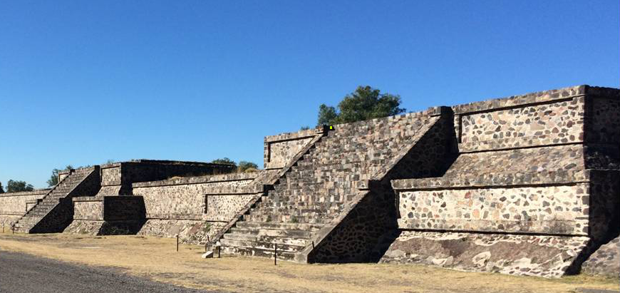
Here is an example: suppose we wanted to do a topographic survey of the archaeological structure shown in the image to the right.
First, the surveyor must take several points. Each of these points has its own unique set of geographic coordinates, and when combined together with the aid of GIS tools, these points can create a bigger picture – a map. Maps like the Moon Pyramid, for example, help us have a better grasp and understanding of our immediate surroundings and environment.
The points obtained by the topographer are then joined in a spreadsheet to form lines. The more points taken, the more accurate our topographic map becomes.
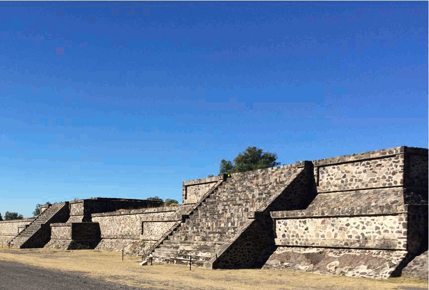
Although this explanation covers the fundamentals of topographic survey, the reality is, of course, more complicated. In the next picture, you can see a topographer with his team taking data from the site in Teotihuacan.

Topographic surveys are an essential tool in archaeology, yet these methods and techniques can also applied to civil construction. At some point or another, you have probably seen surveyors donning a yellow tripod and an orange vest working in your city or neighborhood. Whether you are an archaeologist or civil surveyor, taking multiple points and gathering formation are crucial for building a better foundation and more holistic picture of the area at hand.
During fieldwork, architectural elements such as floors, walls, stairs, large stones, and tepetate (bedrock) levels are carefully mapped. In addition to recording the exact location of each element, these maps are very useful for inferring the continuation of and relationships among walls, floors, or other structures in places that were not previously excavated.
The picture below is a real three-dimensional map of one of the quadrants excavated during the 2015 season:
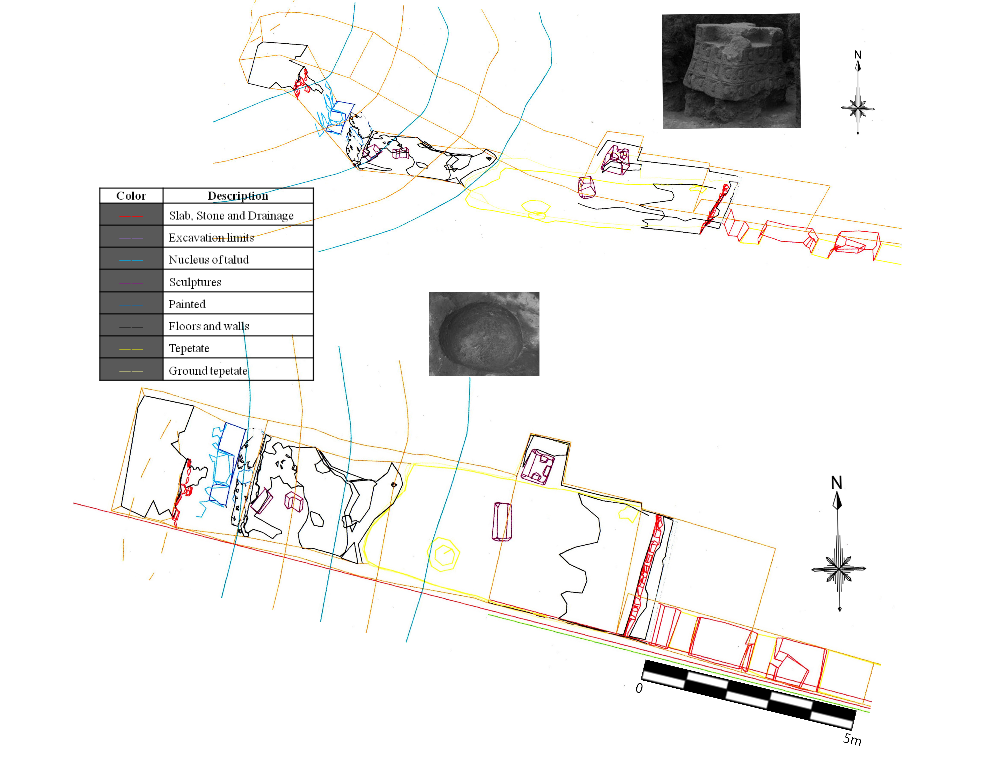
This map is an example of how a pit is recorded, and the key on the left explains what each of the colors symbolizes. For example, the purple lines outline the presence of several sculptures found in this area. In the image, there is a photograph of one of the recovered pieces; can you identify where the others are?
If you look carefully, you will notice that the bedrock level is marked in yellow. There is an excavated pit in the bedrock indicated by a circular yellow line (see photo in the image), which may have contained offerings. However, we cannot know for sure because the site was looted. The three-dimensional maps of the study area constructed in this manner are excellent tools for recording with great precision the context of the materials.