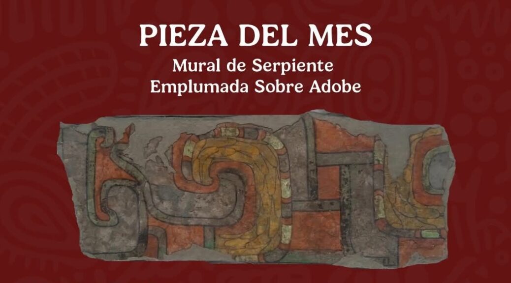
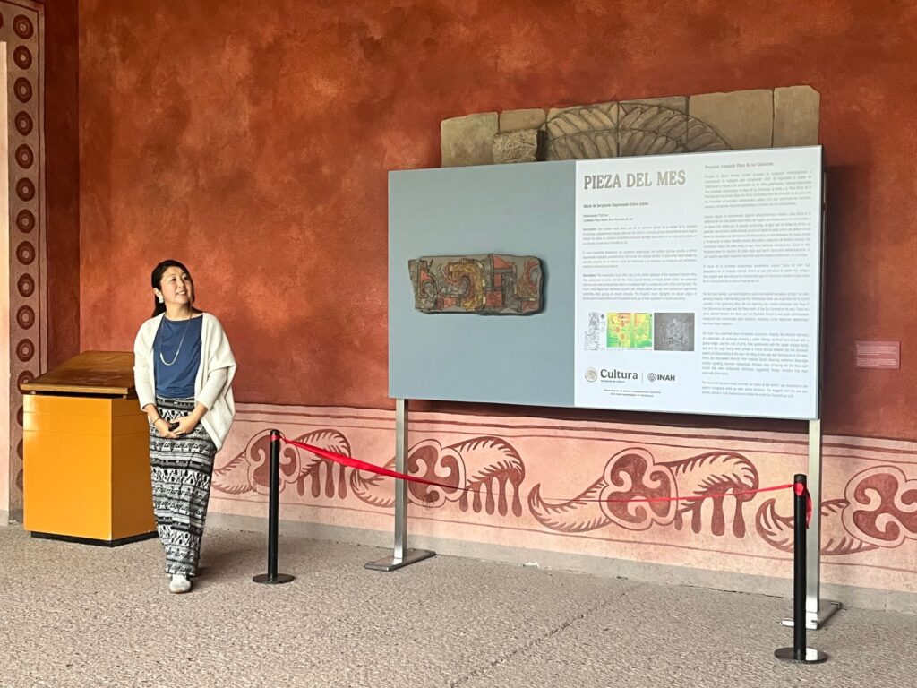
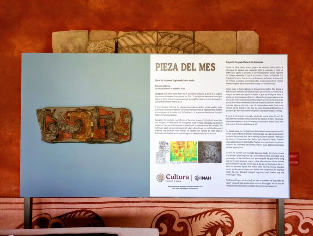
Some years ago, the project’s excavations discovered an adobe fragment with a red strip in a pit at the Plaza North of the Sun Pyramid Complex (see Results 2018-2019, located in Front F’s second “window”). The team decided to extract it as a block and took it to the laboratory.
Afterwards, an arduous process of consolidation and conservation was undertaken. Once a portion of the block was turned over, we were surprised to see it was painted with a design. It depicts two yellow feathered serpents with multicolored bellies (green, red, and black). Furthermore, it is remarkable that this is a very ancient piece, dating from around 250 AD.
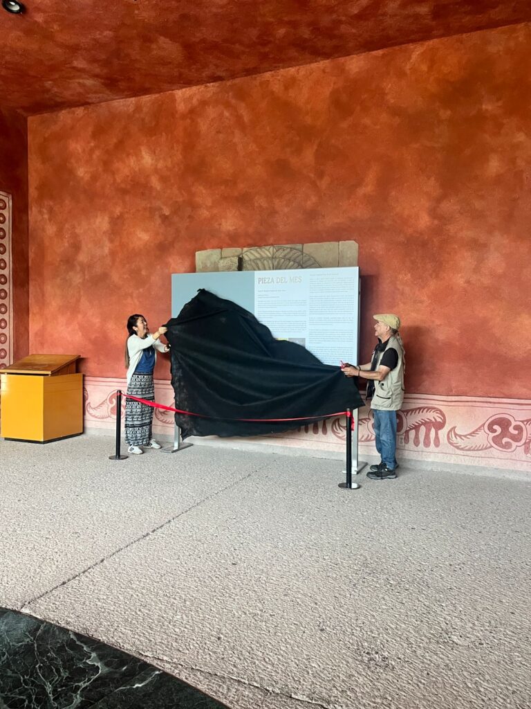
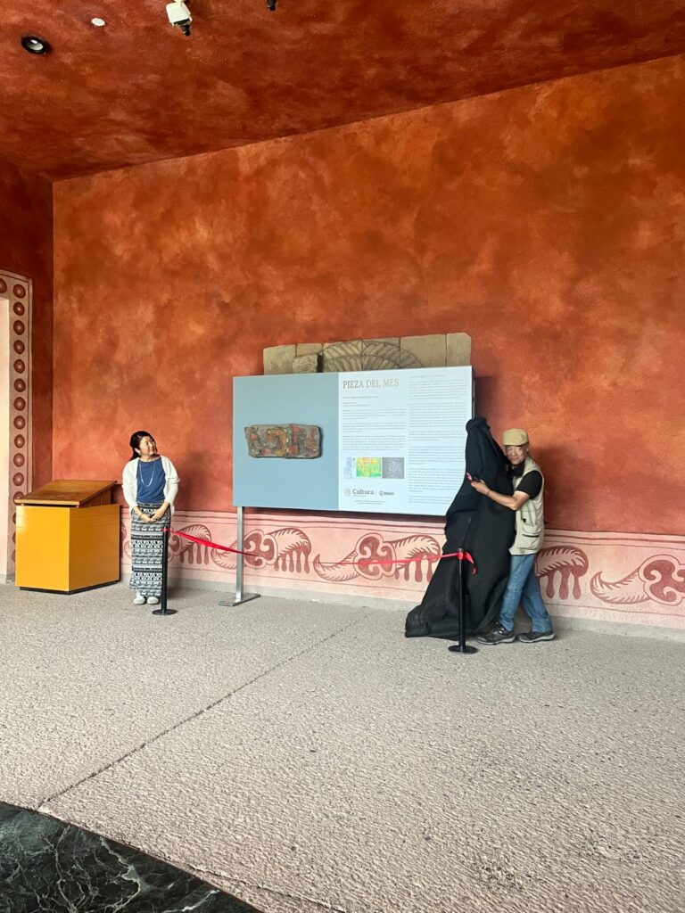
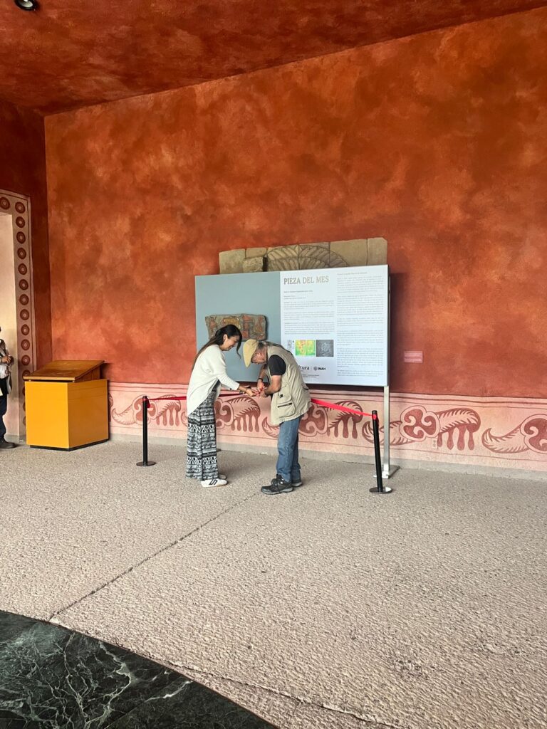
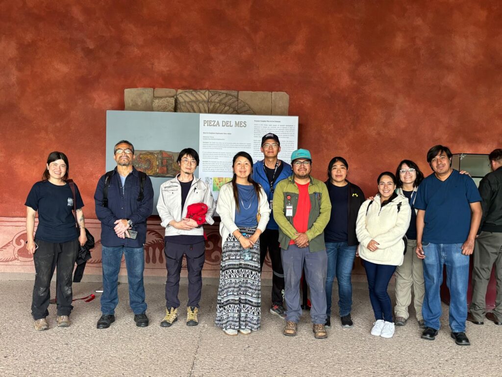
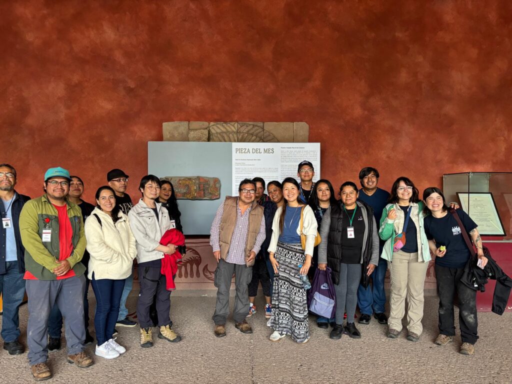
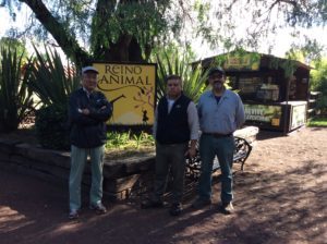
This piece is exhibited at Teotihuacan Archaeological Park’s Site Museum. Come and visit! Here we share a few pictures of its inauguration. We thank all the attendees, the team in charge of the mural’s intervention, and the people who made this exhibition possible, especially Jesús Torres from the Department of Museums and Educational Communication at the Archaeological Site of Teotihuacan, and Rogelio Rivero Chong, Director of the Archaeological Site of Teotihuacan.
Author: Edsel Robles Translation: Yun Ge Editors: Thania Ibarra and Sol Téllez Photographs: Mayté Espinoza
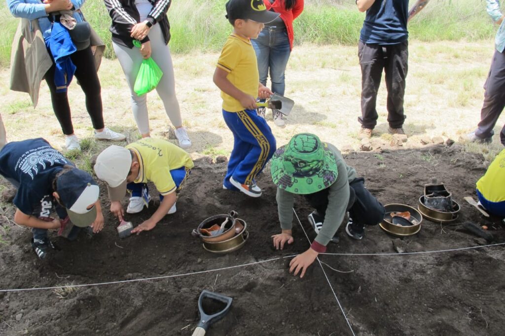
The excitement of the visit from the Xochicalli School students
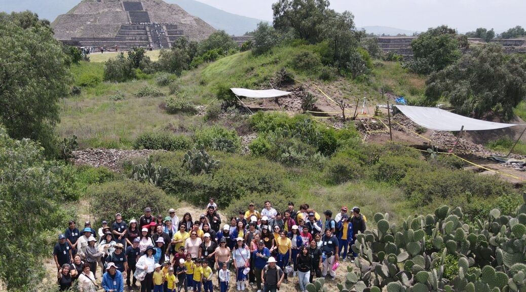
One week before, our PI, Dr. Nawa Sugiyama, informed us that we would be receiving special visitors at the Plaza of the Columns. Our primary visitors are researchers, but this time they would be preschool and high school students. At first, we were a little hesitant, because none of us had studied pedagogy before, but the enthusiasm of looking forward to meeting them, and our experience with family members of various ages encouraged us to accept the challenge of making a wonderful visit. As hosts, we want all our visitors to have a great experience in the field.
Preparing the work
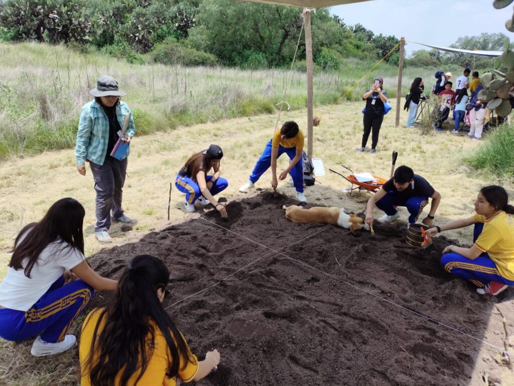
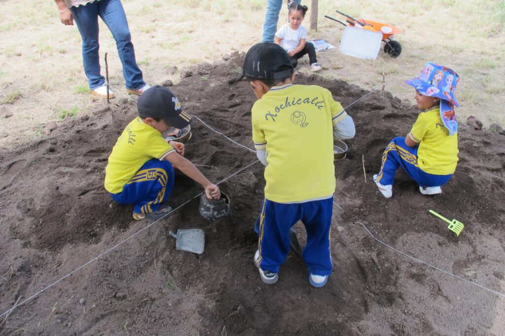
Among all the archaeologists, we brainstormed and designed various activities for the visitors to empirically experience archaeology. The most essential part of archaeology is its excavations and studies based on the major discoveries; therefore, the main activity was to make a small contextual excavation. To make it real, we buried different materials in the artificial deposit beforehand, including ceramics, bones and shells. We intentionally exclude the obsidian to avoid cutting accidents. A 3 x 3 meters “archaeological grid”, delimited by stones, was marked out. To protect our visitors, anything that could cause the mishap was removed. We used sifted soil from our own excavations, and the modern artifacts were placed simulating archaeological contexts. The ceramic pieces we were able to obtain were made by Teotihuacan ceramists and have a similar appearance to archaeological artifacts, making this connection between the past and the present even more realistic.
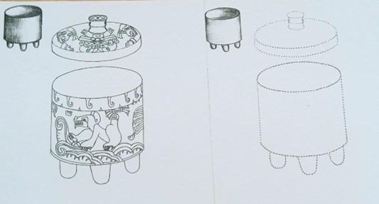
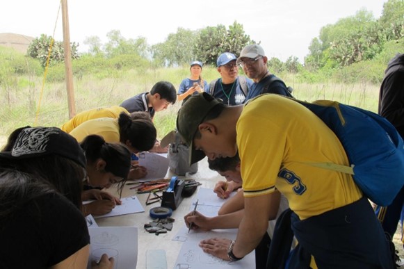
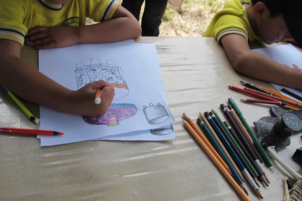
Suggestions were also made for activities the children would undertake after the excavation, such as a field laboratory. Proposed ideas—including puzzles, stories, diagrams, and drawings—were submitted to a vote. We also communicated with family members to find out the preferences of the children based on their age. In the case of drawing pieces, our project artist, Ramiro Medina, made two proposals based on a modern Teotihuacan vase. The first proposal was for the preschool children, which consisted of coloring the vase. For the adolescents, the proposal was simply to place guide points for them to complete the rest of the drawing.
Staging
On Monday, July 14th, in the Plaza of the Columns at the Teotihuacan archaeological site, we finally met the students from Xochicalli School, located in the municipality of San Juan Teotihuacan.
The visitors included both second-year preschool and third-year high school students. Our goal was to share the project’s ongoing activities and to introduce the children to the pre-Hispanic heritage that surrounds them. By reaching out to elementary schools in the communities around the site, we hope to inspire local children—potential archaeologists and future residents of the area—to stimulate their interest in their cultural heritage. In doing so, they may become valuable allies in the preservation of the archaeological remains found throughout their communities.
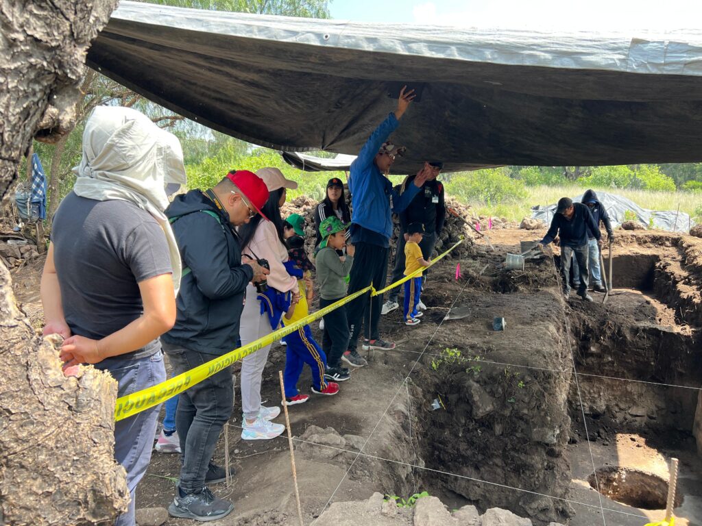
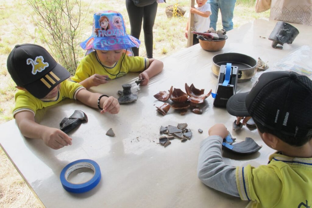
To facilitate meaningful engagement, the students were divided into smaller groups. Three thematic stations were prepared for their visit: a tour of our archaeological excavations, a simulated excavation, and activities in the field laboratories.
“Those mounds you see”
The first activity was a guided tour of the ongoing excavations in the Plaza of the Columns. Students learned that many of the mounds and raised areas visible on the surface often correspond to ancient structures buried beneath the ground. In this area, for example, original floors and walls become visible after removing just a few centimeters of soil, allowing a glimpse into the architectural past hidden below the surface.
The Excitement of Excavation
The second station featured a simulated excavation designed to teach visitors about the importance of the archaeological record and how context helps us interpret the materials we uncover. This hands-on experience sparked a genuine sense of discovery among both the younger children and the teenagers. The children participated with great enthusiasm, guided by archaeologists Thania Ibarra and Sol Téllez, while the teenagers approached the activity more carefully, showing a greater attention to detail as they explored the different layers and contexts.
Debunking Myths
While the visitors participated in the excavation, conversations with the archaeologists continued. The young people raised questions about the dating of the materials and frequently asked about the role of heritage in modern society. Another recurring question among the various groups was what happens if a family member has archaeological artifacts or if there are remains on the property of an acquaintance. In response, the researchers explained that the INAH does not confiscate artifacts that people legally possess, nor are their properties at risk. The importance of not removing archaeological materials found in homes and land was discussed, as important data such as the context would be lost. The importance of contacting the INAH was emphasized, as it is the institute responsible for protecting the country’s heritage and enriching our knowledge of our past.
What’s next?
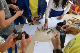
The third activity focused on demonstrating the post-excavation analyses carried out in our laboratories, including cleaning the excavation materials and assembling the broken pieces. This was the part of the visit that sparked the most enthusiasm among students of all ages.
Additionally, there was a Zooarchaeological lab where students learned about the important role animals played in the ancient city of Teotihuacan. Beyond their use as a food source, animals contributed fur, served as pets, and even inspired mural paintings, becoming characters in local stories and legends.
Finally, in the laboratory area, we had the participation of Ramiro, our project’s artist and draftsman. Using a modern made Teotihuacan style vase, the children had helped unearthed during the excavation, Ramiro recreated his work with the visitors, who, depending on their age, were asked to color or draw lines to reproduce the design of the pieces. This activity allowed the artist to observe the different attitudes and aptitudes of the participants. For the younger children, the researcher shared his observations with their parents and offered suggestions on how to nurture their children’s talents. With the adolescents, he provided immediate feedback to help them improve their drawing skills.
Connecting with Young People
The young people were told that Teotihuacan was a great city, home to different ethnic groups, seats of power, architectural periods, etc. From this, the adolescents developed different interests, such as: the most valuable materials, their fashions, trends in building decoration, and the types of construction.
Our Impressions
This activity turned out to be even more rewarding than we had imagined. The active participation of the students—along with the genuine interest shown by parents and teachers, and the wide range of questions and curiosities—demonstrated how deeply the city of Teotihuacan continues to resonate with its local communities. It also reminded us of the many secrets the site still holds, secrets that may one day help us answer those unresolved questions.
We eagerly look forward to welcoming more students from the surrounding communities to explore and connect with the great pre-Hispanic city of Teotihuacan.
We would like to thank Jesús Torres from the Department of Museums and Educational Communication at the Archaeological Site of Teotihuacan for his support in coordinating this visit, as well as Rogelio Rivero Chong, Director of the Archaeological Site of Teotihuacan.
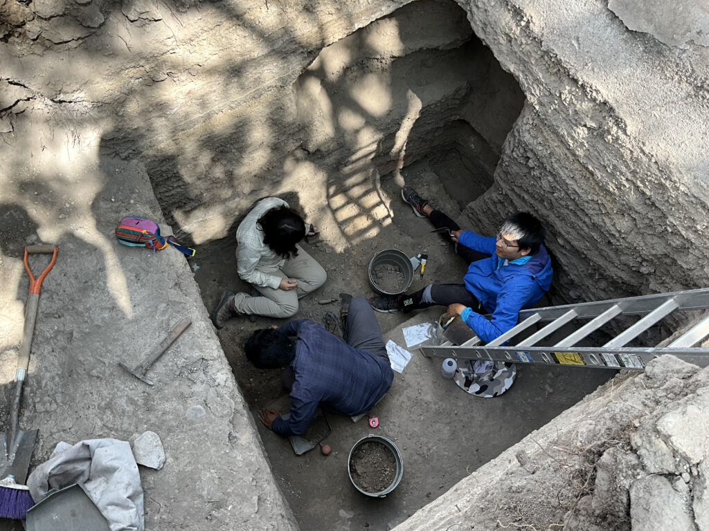
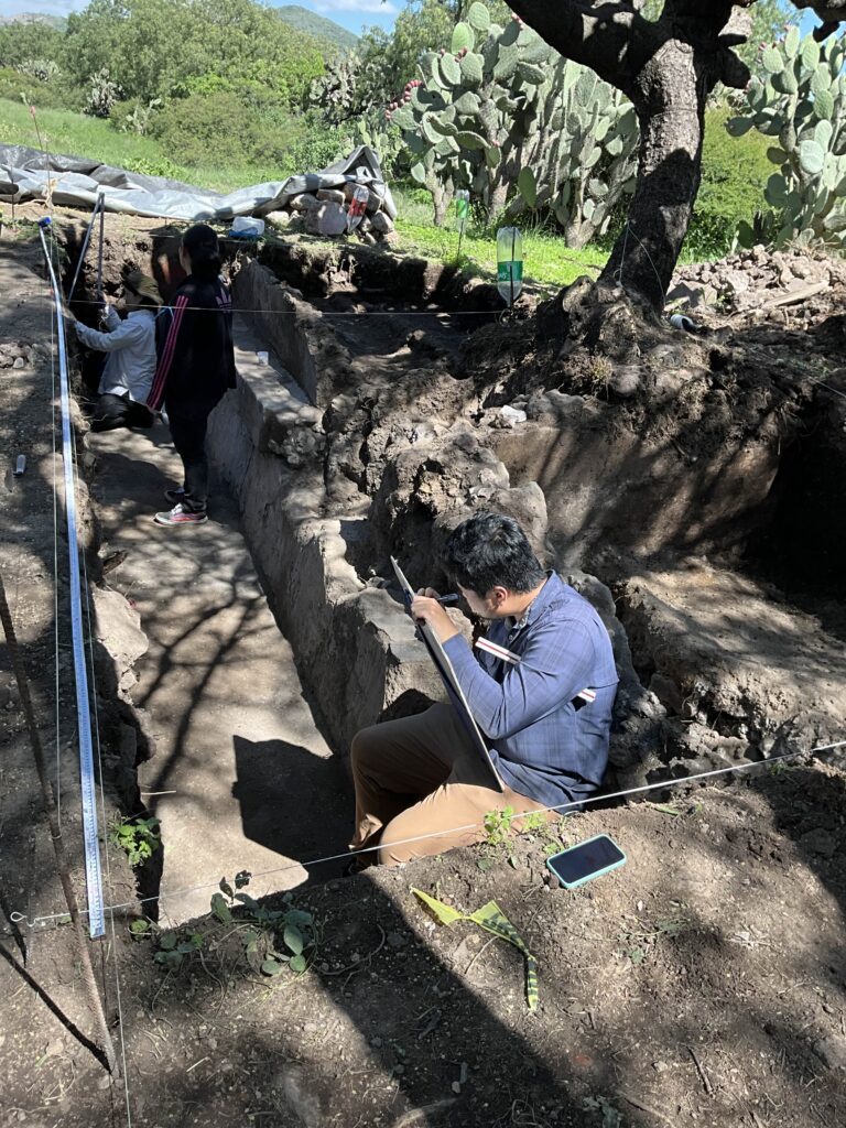
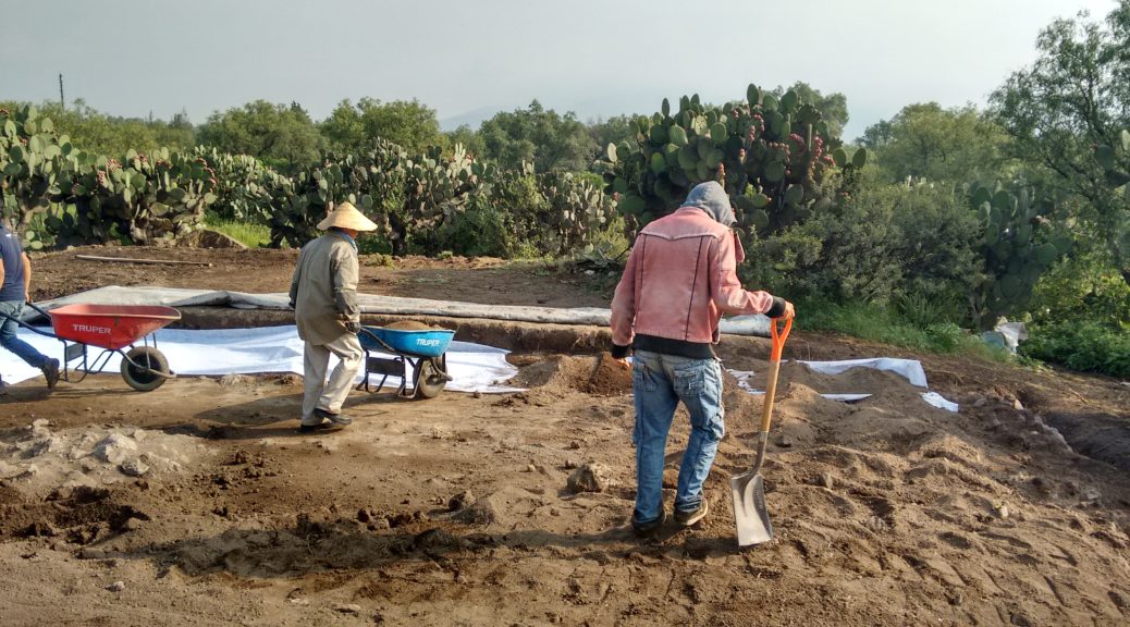
On the surface, archaeology appears simple – go to an archaeological site, start digging down, and haul out all the ancient ‘stuff’ that you can find. But in reality, archaeology involves a great degree of precise and hard work, alongside careful planning and execution in day-to-day operations. Much of the work on an excavation starts even before the first shovel hits the dirt. From simply setting up the excavation early in the morning, to survey and mapping, to detailed sketches of soil layers, to tagging and bagging of site features and artifacts, to the eventual closing down of excavations in the late afternoon, archaeologists and fieldworkers with the PPCC adhere to a daily routine and procedures that ensure we are able to make the most out of each field day and accomplish as much as we can before the months-long field season comes to a close. In this blog entry, I will detail the ins and outs of archaeological excavations in one day at Teotihuacan, so you can get a sense of the work that goes behind digging up those old artifacts you might see in a museum or news article.
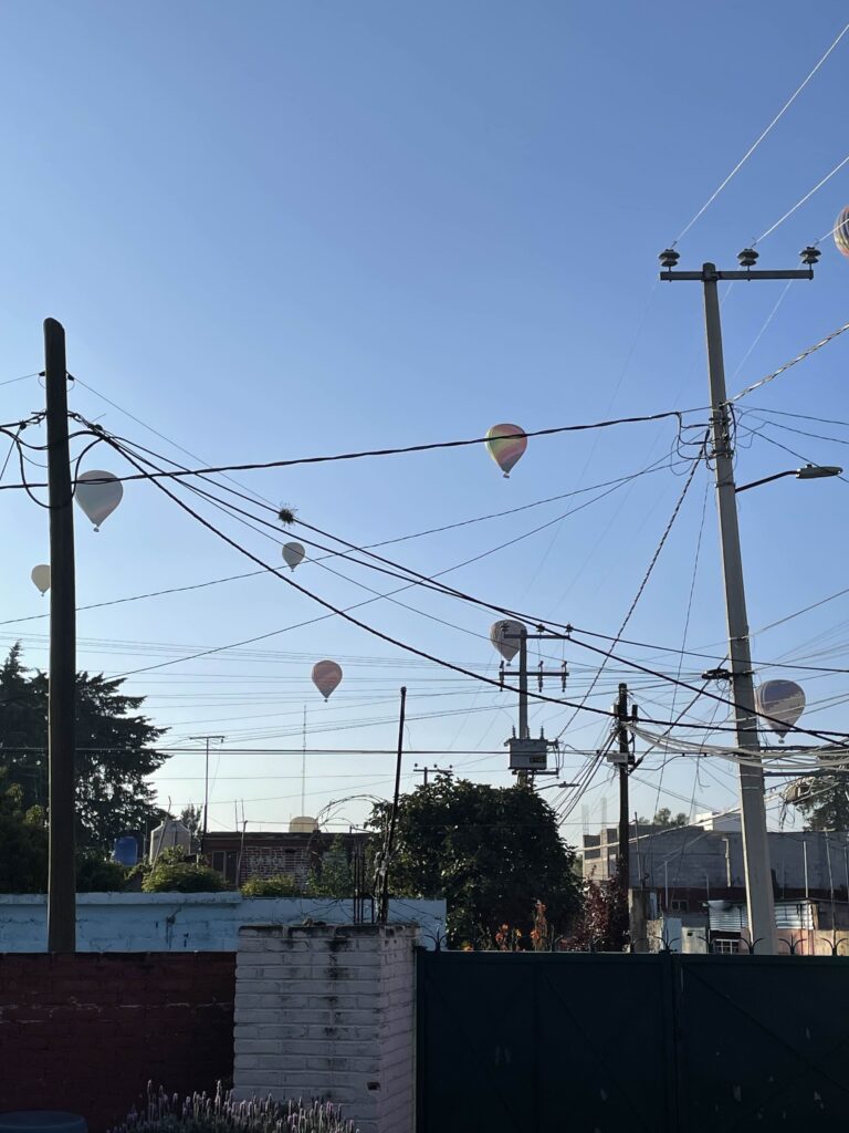
Waking up bright and early around 6:00 AM (for the daring, even earlier; for the especially daring, even later), the PPCC team prepares for departure to the field. After having breakfast and suiting up in our field apparel, which usually consists of long-sleeved shirts, durable pants (pockets come in handy!), good headwear for sun protection, and sturdy boots, we begin loading up the van for departure to the field. The equipment we bring from our base can include things like Total Stations for topographic mapping and surveying, toolboxes with smaller equipment such as trowels, tape measures, handpicks, and hand pruners, and various bags and baskets to store other tools. Some of the larger equipment, like shovels, pickaxes, and wheelbarrows are stored on-site at the excavation in Teotihuacan. At approximately 7:00 AM, the team sets out from our base in San Juan Teotihuacán to the Teotihuacan archaeological zone.
A bright and early morning in San Juan Teotihuacán brings a nice view of hot air balloons flying over the site.
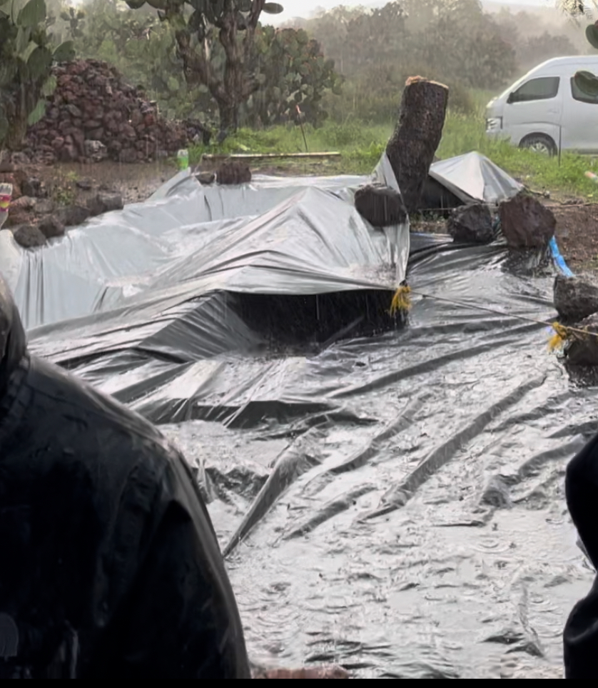
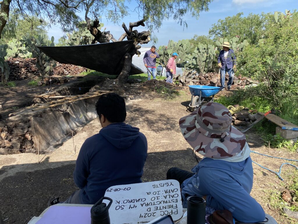
Once we arrive at the site, work begins right at 7:30 AM. We greet the local fieldworkers working with PPCC, who begin helping us unload equipment from the van and storage. As PPCC works during the summer months in Central Mexico, when it can often rain in the afternoon and throughout the night, at the end of each workday we cover the excavation pits with large tarps to protect them – naturally, in the mornings we remove these large tarps to begin working. Usually, we also prop these tarps up over the excavations to provide shade for work in the warm summer days. Afterwards, we go right back to excavating where we had finished the day before, or we open a new excavation pit entirely.
On a particularly rainy day in Teotihuacan, tarps help cover the excavation and protect the soil and architecture inside from getting wet
Before the Dig
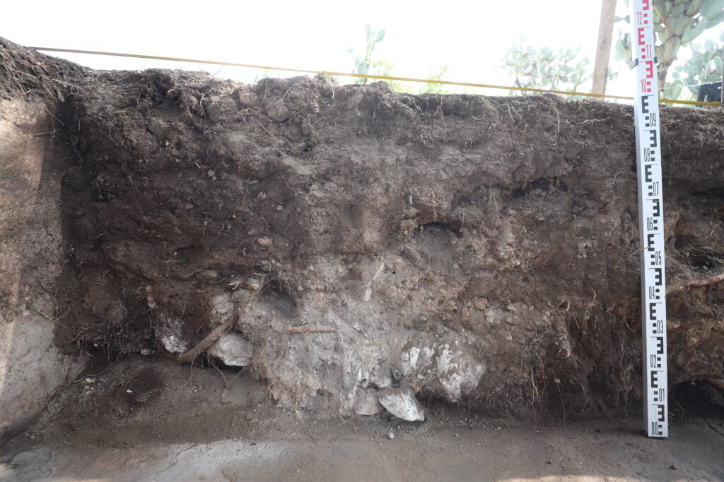
Before going any further, it’s important to describe how we do excavation. Imagine that you have a layer cake with various flavors stacked vertically inside. As you “dig down” through the cake, you may realize that the flavor is vanilla at the top, chocolate in the middle, and then strawberry at the bottom. Eating a layer cake and noticing the changes in flavor is quite like what archaeologists do to systematically excavate a site! We conduct what is known as “stratigraphic excavation”, or a method of digging in which one excavates layer by layer, starting new layers upon noticing changes in soil type, and thus potentially the start of an earlier time period in the site’s history. For example, artifacts found in a layer closer to the surface can be considered to be younger than artifacts found in layers further down, and by taking note of the changes in soil layers (or strata). We can make rough estimations of artifact age and exact locations in the dig by situating them within different strata.
Change in soil along a profile of the excavation in the Plaza of the Columns.
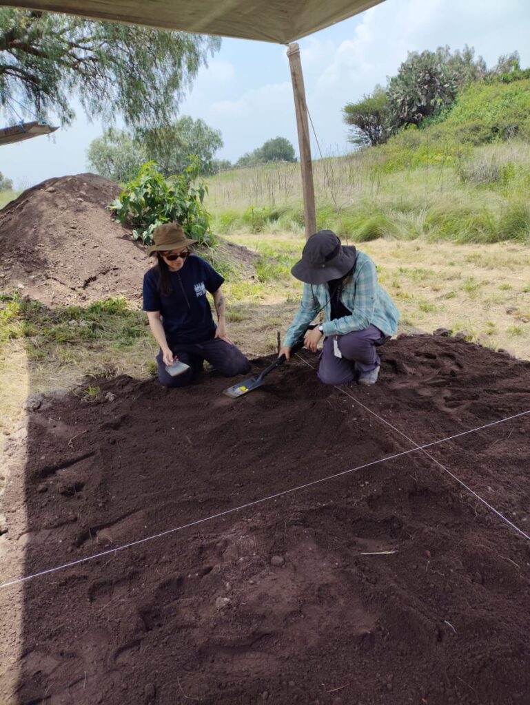
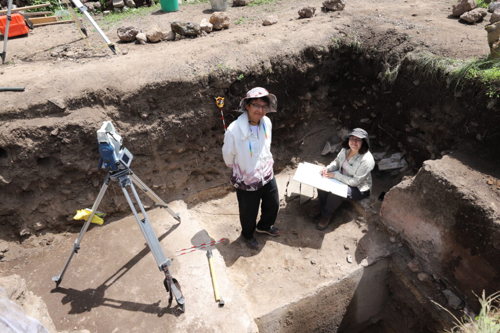
There are a number of things we must measure and do before even putting trowels to turf. Before opening a new pit or starting to dig into a new layer, we take a number of notes on things like the geographic coordinates of the layer or qualitative descriptions of the soil. To discuss this further, it is important to first describe how PPCC actually organizes and plans the excavation. Like many other archaeological digs, PPCC operates on a square grid pattern laid across the excavation site – any new pit opened generally follows the delimitations of the grid, the squares of which measure 3 x 3 meters. Grids are marked by sequential numbers from east to west and sequential letters from south to north. To refer to different parts of the excavation we call them by these names; for example: “Let’s open a new pit in square 18M” or “Let’s expand the pit in square 7K south to square 7J and then west to 8J”. This helps us to spatially situate the dig and make clear, definite explanations of site locations (e.g. “the wall we found extends from 7K to 7J”).
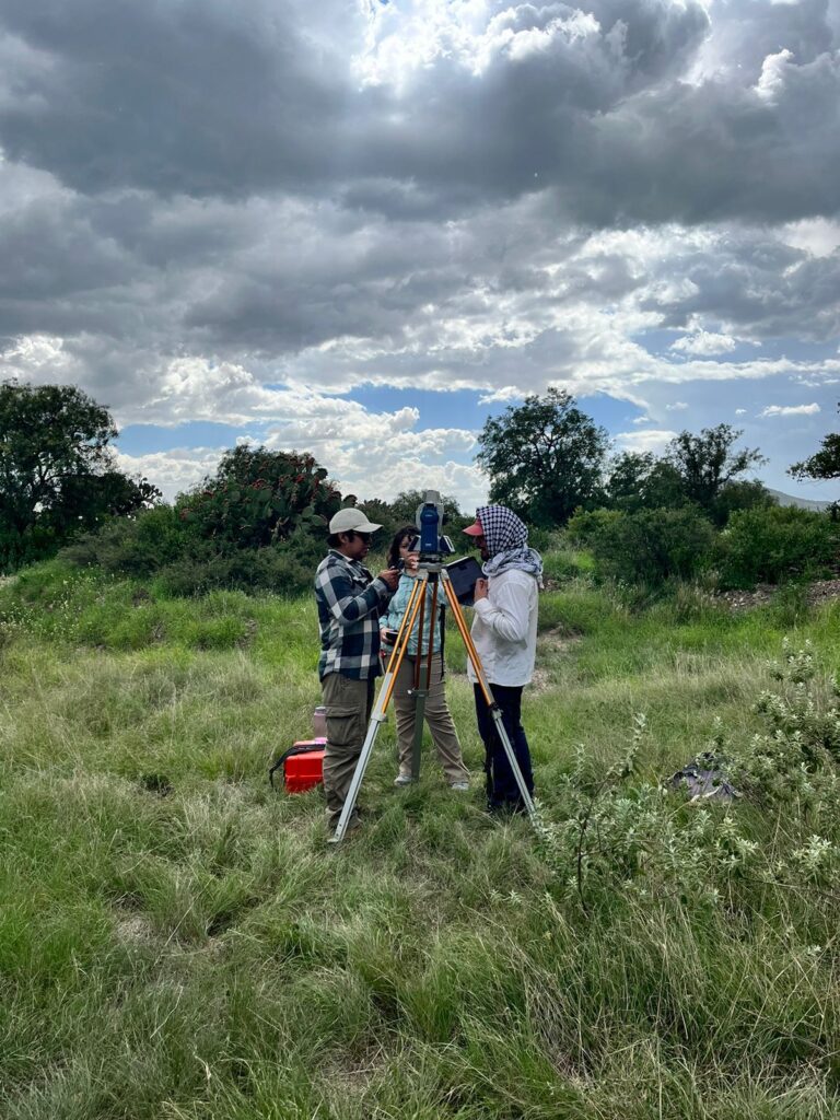
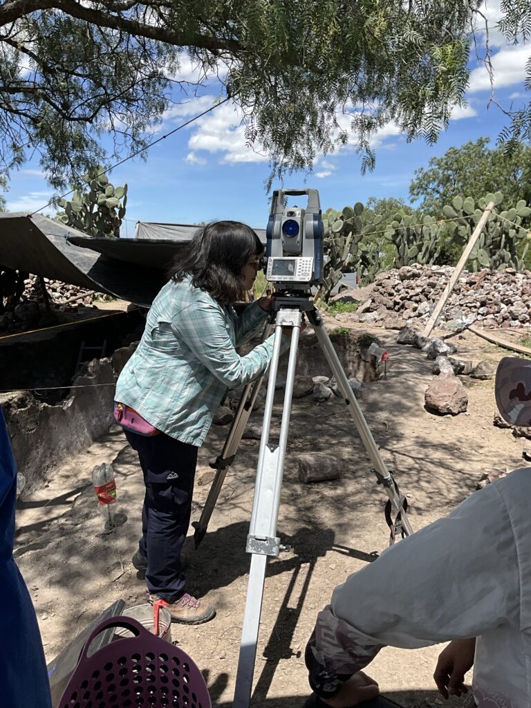
In order to start digging a new layer, first we take survey points using the Total Station. This enables us to have spatial information of the excavation and ensure that we are digging in alignment with the overall grid. This involves setting up the Total Station and a “backsight”, which is another device that the Total Station uses as a point of reference to gauge its own location. The Total Station and backsight are placed at specific locations at the site which have known XYZ coordinates in order to situate the devices in geographical space. All that remains is to point the lens of the Total Station at the surface of the layer we want to excavate, and capture four measurements at the northwest, northeast, southwest, and southeast corners of the square. Together with a telescoping ruler and a “miniature back sight” that the Total Station uses for reference, we get the XY coordinates and elevation in meters above sea level of the four corners of the square.
PPCC Team Working with Total Stations
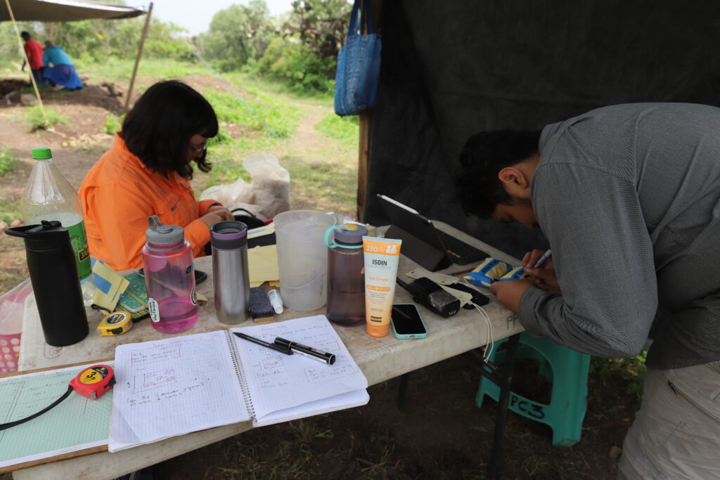
Let’s assume we are opening a new excavation square. Ensuring that the new square is situated where we want it and that it is in line with the rest of the grid, we place four metal rods into the ground at the corners of the square and tie a string between all four, creating a visible box over the surface of the earth. Next, we write down all the information we measured such as surface elevations and XY coordinates. We also evaluate the soil and take notes on its composition, compaction, texture, and possible intrusions like roots or stones, as well as compare the color of the soil to our Munsell Soil Chart, which is a tool that helps us describe the color of soil in a standardized manner. In general, we take a multitude of notes before digging a new layer such as our general objectives, a paragraph or so describing of the layer and its contents, among other quantitative and qualitative data. These Total Station measurements and written descriptions are not just done for the start of an excavation, but for every single time we change layers due to noticing a change in soil texture, color, or any other sign.
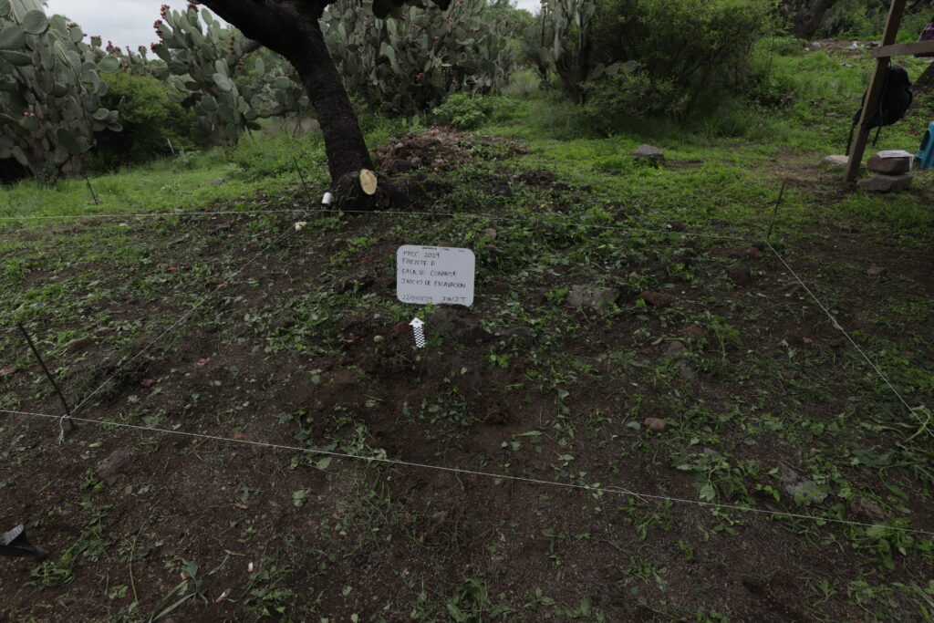
After writing down as much info as possible, we take a photo of the layer before starting to dig so that we have an idea of what it looked like before we literally “dig in”. If we are taking a photo of a layer of soil, we have to clean up the layer before we take a photo so that things are as clear as possible – after doing so with a handful of brushes, brooms, and dustpans, we usually also need to put up a tarp to provide shade, so that shadows cast by the sun do not disturb the image. Often this is already done, as we put the tarps over our heads for shade, but sometimes you need a helping hand or two to provide some additional shadows for a better-quality image. Finally, alongside a scale and north arrow for reference, we place a whiteboard in the pit with information such as the date, name of the structure or the Front in which we are excavating, name of the square, highest elevation of the surface, and other notes that help explain what we are looking at in the photo. After taking the photo with both on-site iPads and digital cameras, we can (finally!) start to dig.
Photo taken before the start of excavation, with whiteboard, scale, north arrow, and box boundaries indicatedCleaning up a layer and preparing a whiteboard prior to taking a photo
Doing the Digging
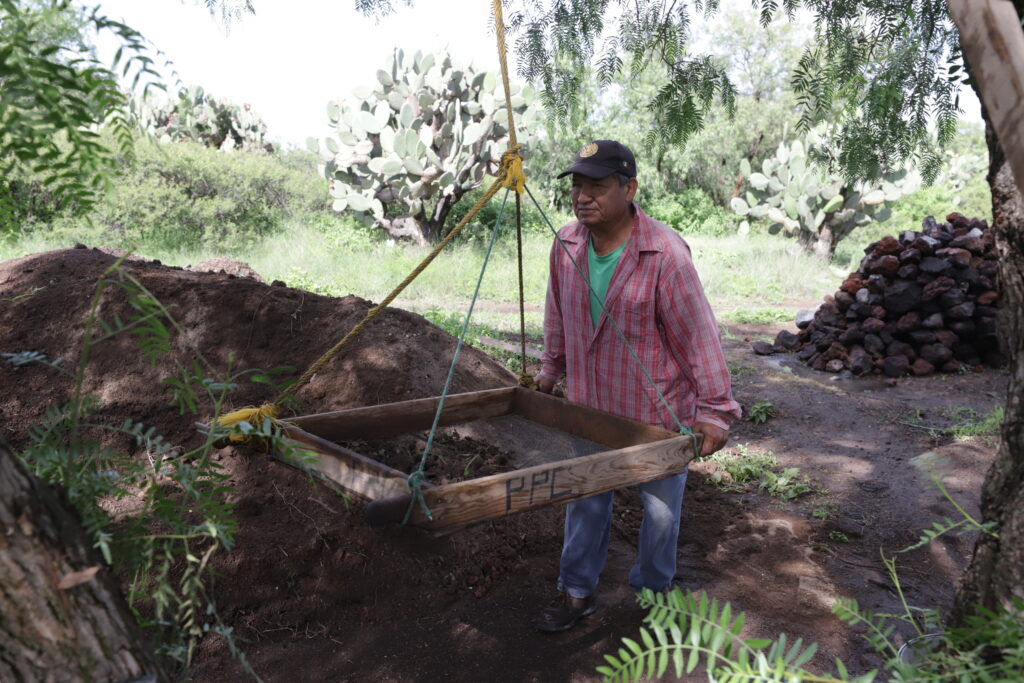
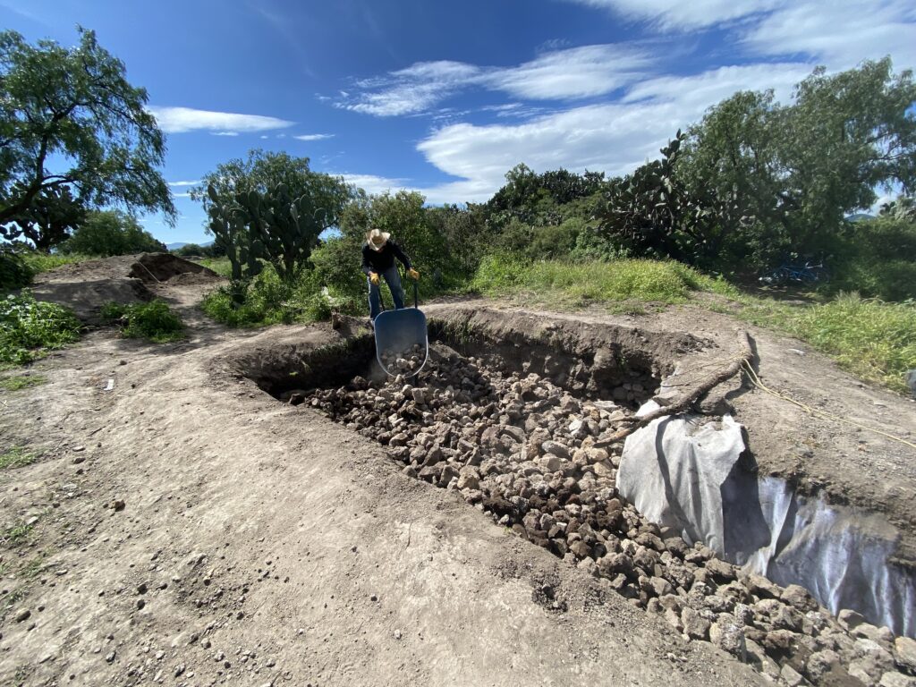
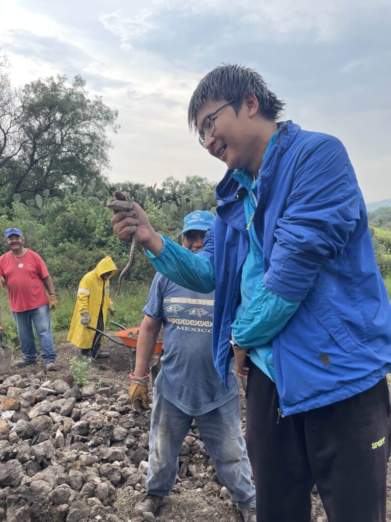
Fieldworkers put excavated soil into buckets which are then carried over to a nearby mesh screen. The soil is sifted through the screen, as smaller soil particles fall through, and larger objects are caught in the mesh wire. These larger objects can range from simply large natural stones to actual artifacts, such as ceramics and stone tools or organic materials such as charcoal or bones. These materials are placed in plastic bags for safekeeping. Organic materials like charcoal are treated with more care, extracted with sanitized trowels and placed in special Whirl-Pak bags, as charcoal can be used in further analyses like radiocarbon dating. This way of handling helps keep it uncontaminated, as human hands can contain contaminants that will disturb further analysis. All the dirt and rocks we find in the excavation are tossed into piles around the edges of the excavation – when the excavation is all over at the end of the season, we actually throw all the soil and rocks back into the earth in a process called “backfilling”, re-covering the architecture and exposed soil such that it looks like we were never even there.
PPCC fieldworker screens buckets of soil to find materials.PPCC team excavates a pit with trowels, handaxes, pans, buckets, brushes and shovelsRock piles at TeotihuacanBackfilling at the end of the season
We can find things on a much larger scale than just artifacts, and sometimes an excavation can unearth whole features such as walls, plaster floors, and postholes constructed by the ancient inhabitants of Teotihuacan. Obviously, we can’t exactly place these in little plastic bags, so upon encountering something like a wall or floor we do our best to preserve it in its original state and take as many measurements as we can of its location, height, length and width, general form, and relation to other features. We may even take samples of them for further analysis by doing things like drilling into a floor to retrieve a small piece or scraping small parts of walls off. Additionally, we can also take samples of the soil, often that which is above ancient floors or adjacent to material deposits, for analysis – these samples are treated with a similar care to charcoal samples, as we also try to avoid contaminating these as well.
Once it is time to change layers, we take all the bags of materials found in that layer, seal them, and attach a tag with information such as a bag number, the type of material, the name of the Front, structure, and layer in which the materials were found, and the elevations of the layer derived from our Total Station measurements. All of this information is also entered into a material database through our on-site iPads. The materials are then placed in baskets and loaded into the van, where they will be taken to an on-site facility for analysis and storage at the end of the day.
Writing tags for soil samples under the “casita”.
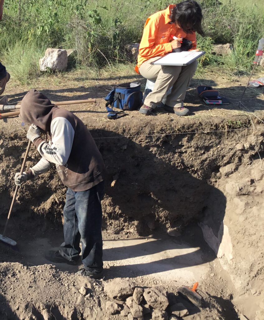
Throughout the process of digging layers and finding materials, we continue to do things like taking photos and Total Station measurements. Once we feel we have excavated down to an appropriate endpoint, we take aerial photos of the square with a drone and take multiple photos of the excavation for a process known as photogrammetry, which can produce digital 3D models of the excavation by stitching together photographs taken from different angles. One important process of archaeological documentation is profile drawing, which involves hand-drawing a sketch of the stratigraphic layers visible on the sides of the excavation. This involves laying a string horizontally across the side of the excavation at a certain height above the surface. Next, we measure how far down from the string different objects are, along this horizontal axis. These objects include the various layers like the earth’s surface or construction fill, intrusive rocks, or even architectural features such as floors. It is also possible to draw profiles using the total station, to measure exact distances, this is useful when drawing profiles that are especially large or deep. A fully drawn profile gives you detailed stratigraphic information as well as approximate architectural dimensions, which prove invaluable for further analysis.
Profile drawing in the Plaza of the Columns.
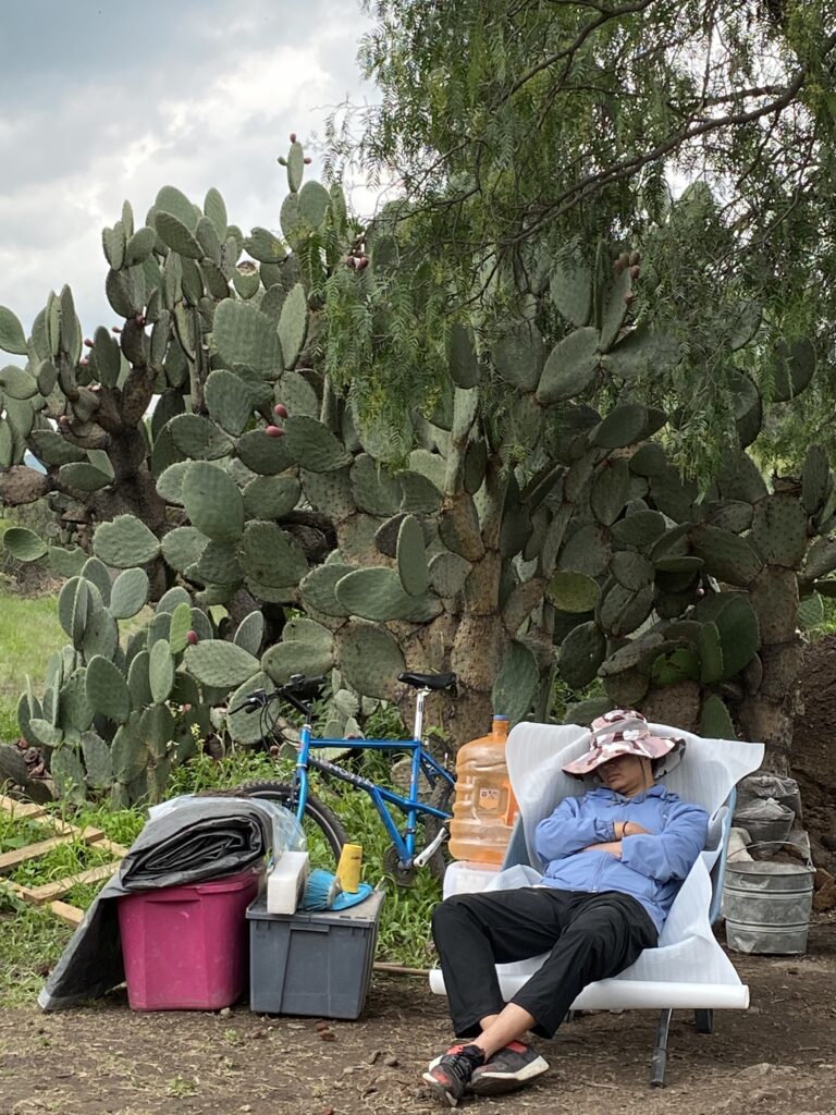
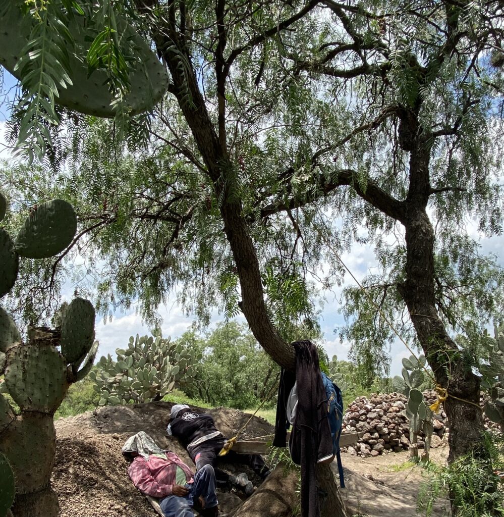
All Work and No Play?
Excavation is a hard and arduous work – but we’re not constantly in the pits, digging, drawing, or writing from morning to evening. From about 12:00 to 1:00 PM, after a good 5 hours or so of work, we take a break to eat and relax, and some members of our team find it a good time to take a nap.
Naptime at Teotihuacan
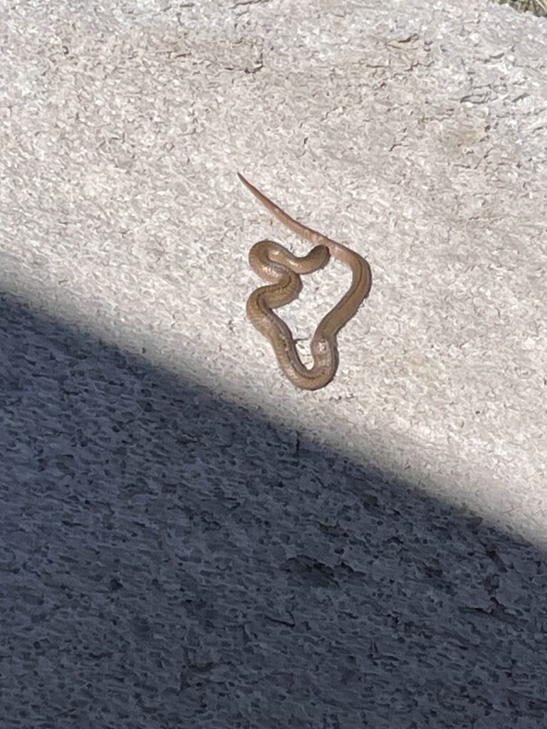
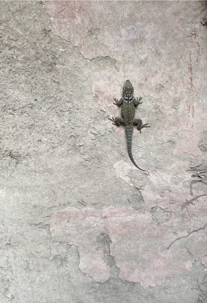
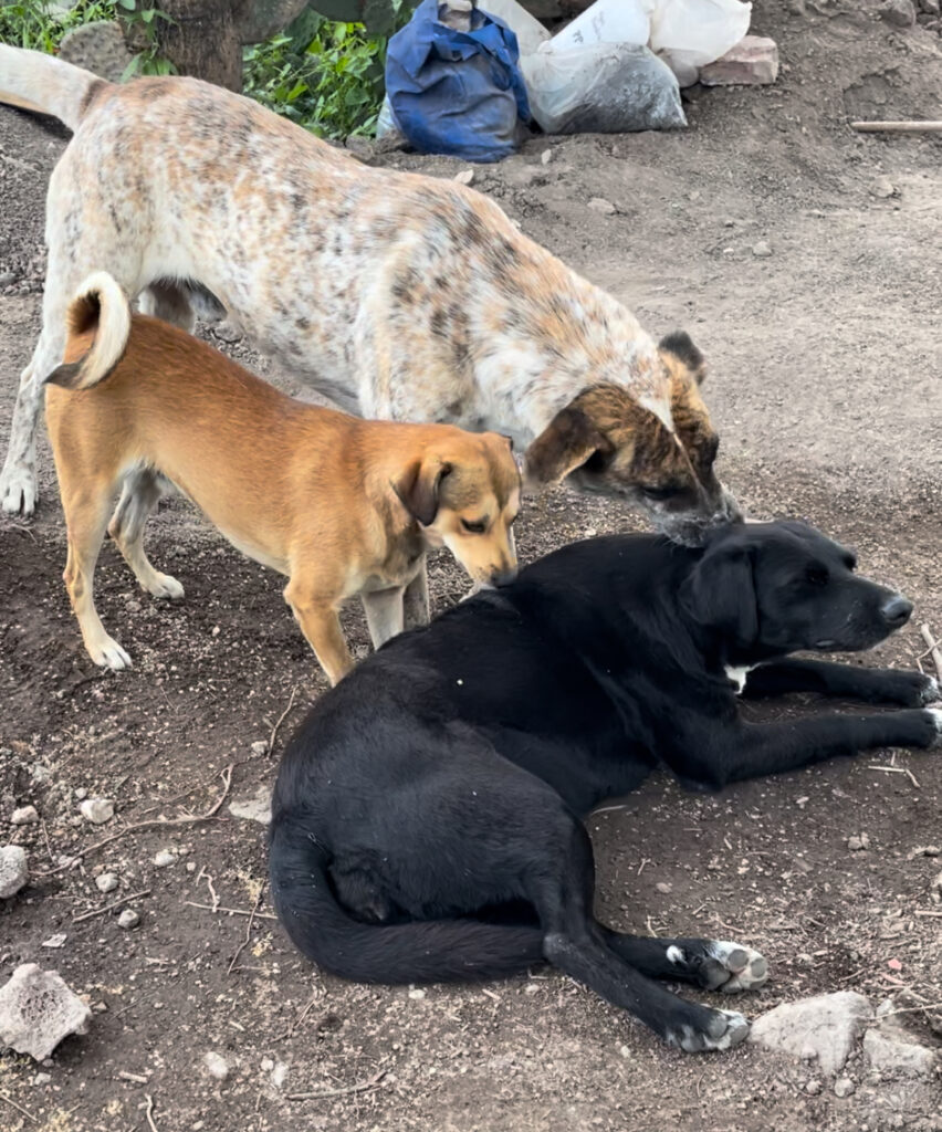
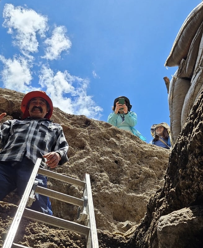
Far from boring, the PPCC pit is a lively setting. Throughout the excavation we chat, visit and check out each other’s excavations and other Fronts, have small snacks and drinks in our little “casita” shack, and listen to music, amplified to the whole excavation through the ingenious process of placing a Bluetooth speaker in a bucket. At times we have visitors who come to take a look at the excavation, and PPCC team members help to show them around and explain a little bit about what we are doing and the amazing things we are finding every day on the dig. The visitors aren’t always human, either!
Animal friends visiting the excavation
At around 4:00 PM, at the end of a long day of work, it is time to pack up for the day. We place the large tarps back over the excavation and secure them down with large stones, and load the tools like trowels, brushes, and Total Stations back into their toolboxes and storage cases. Wheelbarrows filled with shovels, pickaxes, and plastic stools get wheeled back to the storage shed. The PPCC team, archaeologists and fieldworkers alike, say their goodbyes and start going home, and the van loaded with all the materials collected that day goes to drop them off. After all is said and done, the team returns home for dinner, rest, and – hopefully – a nice shower.
Work on the project isn’t always being done on-site, however. On days when we are not in the field, often at the end of the work week, we spend time back at the base processing everything we have collected that week. Photos are described and registered in a database, all the notes and descriptions made of soil layers and findings are consolidated into a project digital notebook, profile and plan drawings are digitized in Adobe Illustrator, and Total Station points are saved and stored on project computers. All of this is done to help with writing the end-of-season report, to ensure that our findings are properly documented and the information we uncover is saved for future research and further excavations.
Life at the dig in Teotihuacan is anything but dull and is certainly far more complex than just picking a site and digging straight down. From artifact tagging and bagging, to profile drawing, to Total Station survey, and more, our team thoroughly plans and carries out the excavation of the site such that we can obtain as much information as possible in a relatively small amount of time about the activities, architecture, materials, and culture of ancient Teotihuacan. Now, the next time you read an article detailing a new archaeological find or take a look at an ancient artifact in a museum, you can imagine all the hard work and careful effort going on behind the scenes so that ancient history and culture is preserved for us to learn more about our past.
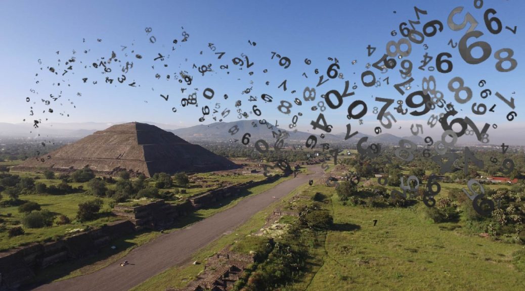
Teotihuacan was one of the most influential cities in Mesoamerica, and descriptions of its grandeur during its occupation from around 100 BCE to 550 CE have been frequently mentioned in literature. At its height, the metropolis had between 75,000 to 125,000 inhabitants and extended over an area of some 20 km2 (7.72 mi2). The biggest building in the city, the Sun Pyramid, stands at 63 m (206.69 ft) tall with each of the four sides of its base measuring 222 m (730.64 ft).
So, why all these numbers and figures? Well, get ready because the point to this blog entry is to break down these numbers and compare them with other cities, monuments, and areas around the world so you can have a better understanding of (and appreciation for) the impressive dimensions of the Teotihuacan metropolis.
Years of occupation: 100 BCE-550 CE
Fact: Learning about history is much more interesting than memorizing dates. However, dates are useful for understanding the relative timeframe between which certain events occurred. Teotihuacan was occupied thousands of years ago for centuries. How long ago was that? What was happening in other parts of the world at that time?
The city of Teotihuacan lasted a duration for about 650 years. If we are living in 2021 (21st century), the year 1371 (14th century) was 650 years ago. The Black Death hit Europe, and Dante Alighieri wrote the Divine Comedy during that century. If you think about how much time has passed and how the world has been transformed since then, you will understand that 650 years was a long time, indeed.
According to the chart below, which summarizes the estimated dates for the ceramic phases of Teotihuacan (Cowgill 2015), the city was seemingly occupied from the Patlachique to the Late Xolalpan phases with its collapse beginning around 550 CE (Manzanilla 2018:213-215). If you want to learn more about ceramics and chronology, visit the Relative Chronology section.
Phase
Time period
Patlachique
100-1 BCE
Tzacualli
1-100 CE
Miccaotli
100-170 CE
Early Tlamimilolpa
170-250 CE
Late Tlamimilolpa
250-350 CE
Early Xolalpan
350-450 CE
Late Xolalpan
450-550 CE
Metepec
550-650 CE
What about Europe? What was going on during that period? The rise of Teotihuacan (Patlachique phase) roughly corresponds with the beginning of the Roman Empire, spanning between 27 BC and 476 CE (Britannica 2021). By the time we reached the 6th century when Teotihuacan was abandoned, the Early Middle Ages were beginning.
Estimated population: ca. 75,000-125,000 inhabitants
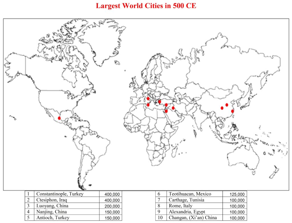
If there were any population records taken back in the day, they were not preserved in Teotihuacan. Therefore, we do not know the exact number of people that lived in the city. Archaeologists have, however, calculated an estimated figure. René Millon (1973:44-45)[1] estimated that there were between 75,000 and 125,000 people in Teotihuacan at its height. Comparatively, in 2017 the city of Bruges in Belgium had 118,284 inhabitants (UrbiStat s.f.). This might seem like a small number compared to the biggest cities at present, but think of it like this: Teotihuacan was the biggest city in the Western Hemisphere (Cowgill 2015:1) and the sixth largest city in the world (Millon 1994:17) (Figure 1).
[1] There are other more recent and less generous calculations (e.g., Cowgill 2015), but Millon’s estimate is used here to be consistent with the map in Figure 1.
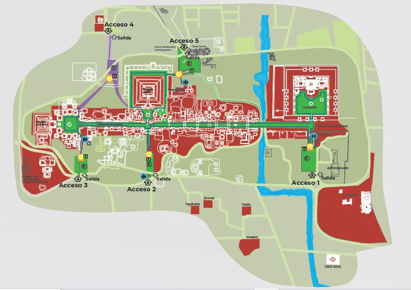
The main area the public can visit in Teotihuacan’s archaeological site is the city’s ceremonial center which stretches across an area of 2.4 km2 (0.92 mi2) (INAH 2021) (Figures 2 and 3). To put this number in perspective, the country of Monaco in Western Europe measures 2 km2 (0.77 mi2) (Viajes NG 2021) and New York’s Central Park measures 3.41 km2 (1.31 mi2) (Britannica 2020). Even further, the area that tourists frequent is only a small percentage (around 12%) of the maximum extent of the city (20 km2 or 7.72 mi2) (Millon 1973:xi), which is comparable to the Republic of Nauru (21 km2 or 8.2 mi2), an island country in Micronesia (Viajes NG 2021).
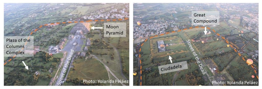
Figure 2. Teotihuacan’s Archaeological Zone (taken from INAH 2021).Figure 3. Photos of Teotihuacan’s archaeological site taken from a hot air balloon: a) northern region including the Moon Pyramid and part of the Plaza of the Columns Complex, b) southern region including the Ciudadela and the Great Compound. The border of the archaeological site is shown in orange with contemporary towns located on top of the ancient city.
Dimensions of the Sun Pyramid
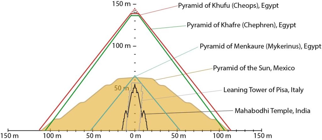
Approximate Height: 63 m (206.69 ft); Base: side length: 222 m (728.34 ft); area: 49,248 m2 (530,101.06 ft2) (Sugiyama 1993:112).
While Teotihuacan’s biggest monument is the Sun Pyramid, we actually do not know its original height because it has suffered many natural and human destruction over the centuries and consequently several reconstructions along the way (admittedly not always completely accurate). In the present day, however, the pyramid measures 63 m (206.69 ft) (Sugiyama 1993:112). In comparison, the Mahabodhi Temple in India (55 m or 180.44 ft) (Britannica 2019) and the Leaning Tower of Pisa in Italy (56.67 m or 185.92 ft) (Leaning Tower of Pisa 2021) are similar in height.
From these numbers, the Sun Pyramid is still more massive than these two monuments. Each of its sides measures 222 m (728.34 ft) with an area of 49,248 m2 (530,101.06 ft2). Have you ever been to a stadium and thought how small you are in comparison to the total space? Well, the Principality Stadium in Cardiff, Wales, also known as Millennium Stadium, has a footprint of 40,000 m2 (430,556.42 ft2) (Principality Stadium 2021). A building with a similar area (52,609 m2or 566,278.56 ft2) is the Windsor Castle (Royal Borough of Windsor and Maidenhead 2021).
When you think of pyramids, surely the famous Egyptian monuments from the Giza Pyramid Complex come to mind. So, how does the Sun Pyramid compare? The following table breaks down the measurements of each of the Giza Pyramids (Britannica 2021) as compared to the Sun Pyramid (Sugiyama 1993:112).
Building
Height
Base side length
Pyramid of Khufu
147 m (481.4 ft)
230 m (755.75 ft)
Pyramid of Khafre
143 m (471 ft)
216 m (707.75 ft)
Pyramid of Menkaure
66 m (218 ft)
109 m (356.5 ft)
Pyramid of the Sun
63 m (206.69 ft)
222 m (728.34 ft)
As you can see, the Sun Pyramid is similar in height to the Menkaure Pyramid. Although the Kuru and Khafre pyramids are taller than the Sun Pyramid, their bases are comparatively similar in length (Figure 4) and thus in area as well.
Figure 4. Sun Pyramid compared to some of the buildings mentioned in the text (modified from Cmglee 2016 by Yolanda Peláez).
A Magnificent City
With over six centuries of occupation, Teotihuacan supported an impressively large population across an extensive landscape enhanced by monuments of global proportions. The next time you visit the site, think about what these numbers mean in terms of human ingenuity. Without fortitude and strength, a city would cease to exist. For this reason, Teotihuacan is a paragon of what a city built on a complex and powerful sociopolitical foundation can achieve for centuries on end.
Manzanilla, Linda 2018 Corporate Societies with Exclusionary Social Components: The Teotihuacan Metropolis. Origini, Prehistory and Protohistory of Ancient Civilizations XLII:211-225.
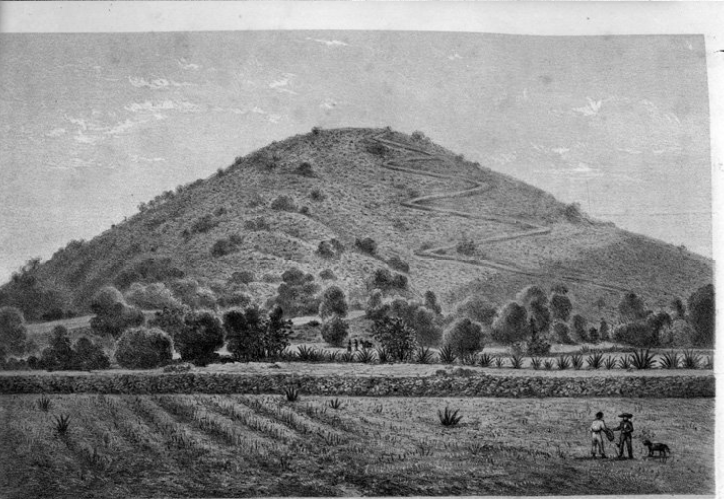
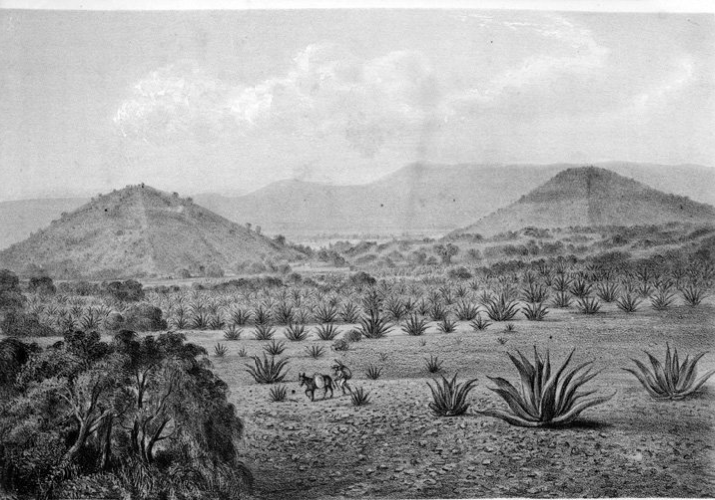
Today, it is very easy to photograph and document the world around us. For example, people visiting Teotihuacan can take countless photos and share them on social media immediately; however, in the past, it was much harder to capture and reproduce images. The lithographs, paintings, and photographs from the end of the 19th century to the beginning of the 20th century demonstrate the many changes that the archaeological zone of Teotihuacan has undergone. Most of the images here can be found at INAH’s Media Library.
Developed in the late 18th century, lithography is a printing method which has been used to preserve images that explorers saw. In lithography, an image is engraved on a surface (usually limestone), ink is applied, and then the stone is pressed into paper (Tate 2021). This process allowed for a wider distribution of images of sites such as the Teotihuacan pyramids and its scenery during the 19th century.
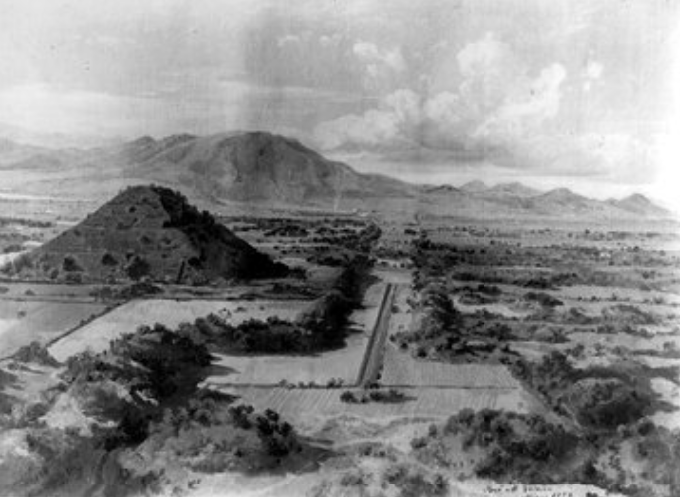
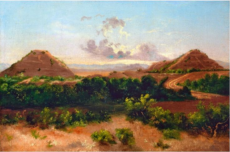
José María Velasco (1840-1912) was a Mexican painter who accompanied Gumesindo Mendoza in his expeditions to Teotihuacan and portrayed the city’s landscape in his paintings (Google Arts and Culture s.f.). Teotihuacan was abandoned around AD 550, so after some 1,300 years had passed, there was certainly a lot more vegetation covering the monuments for Velasco to capture.
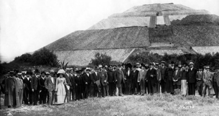
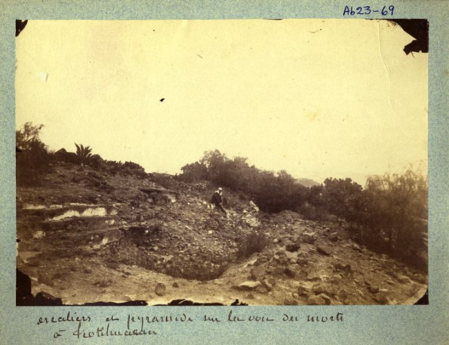
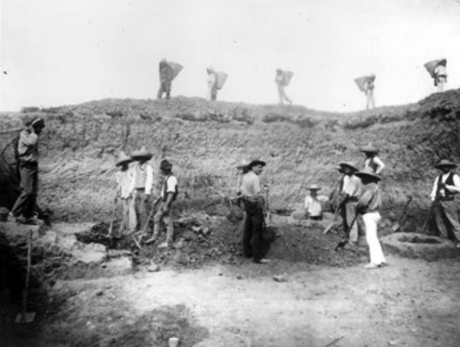
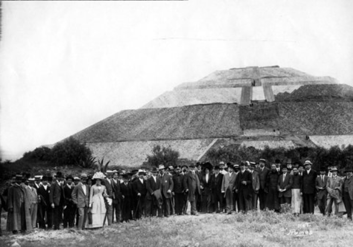
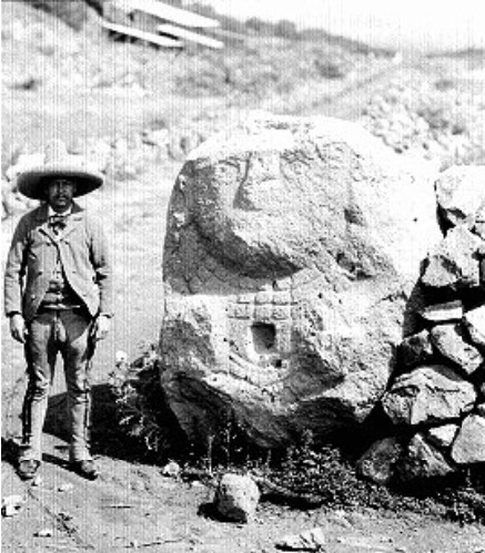
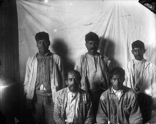
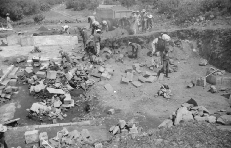
The first archaeological work began on site in the early 20th century by Leopoldo Batres to commemorate the centennial of the Mexican War of Independence. Batres was commissioned by President Porfirio Díaz to explore and restore some of Teotihuacan’s monuments. This project included reconstructing the Sun Pyramid, building railway lines, and discovering murals in the Temple of Agriculture (Batres 1993 [1919]).
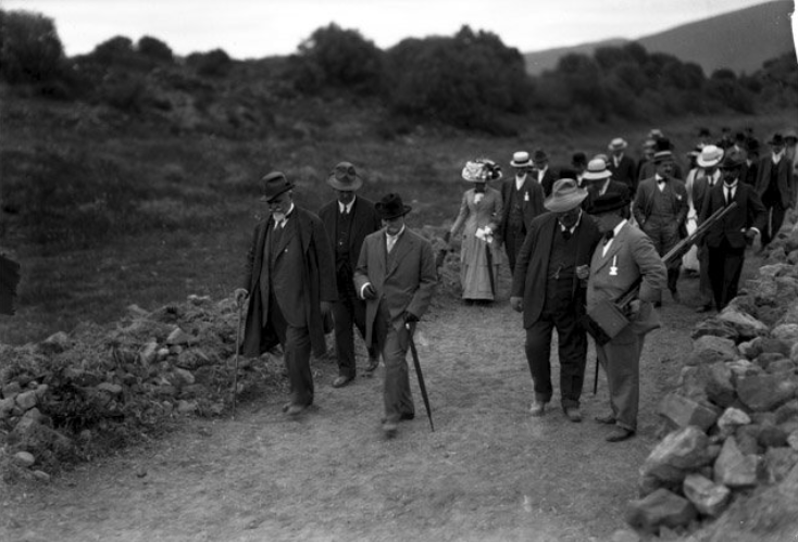
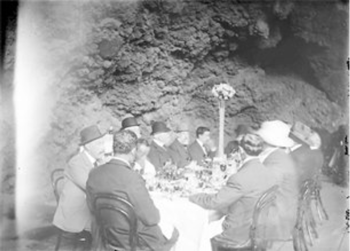
The excavation, restoration, and reconstruction of Teotihuacan continued through the 20th century. The rest of the photographs here likely refer to:
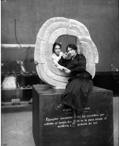
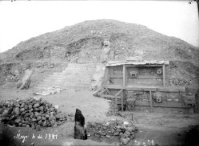
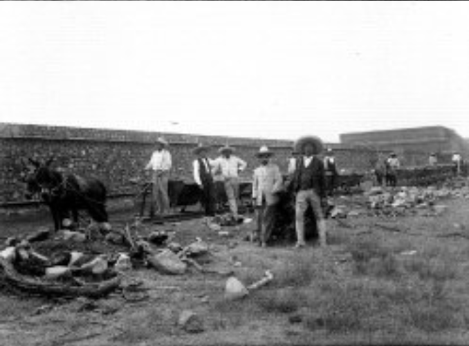
The project directed by Manuel Gamio where he carried out a comprehensive study of the population in the Teotihuacan Valley (Gamio 1922). Some of the work his team accomplished include the excavations of the Ciudadela as well as the exploration and restoration of the Feathered Serpent Pyramid and its attached adosada (Figures 15-17).
Excavated pits in the Ciudadela and tunnels in the Feathered Serpent Pyramid by José Pérez under the direction of Alfonso Caso (Pérez 1997:488 [1939]) (Figure 18).
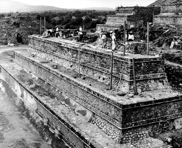
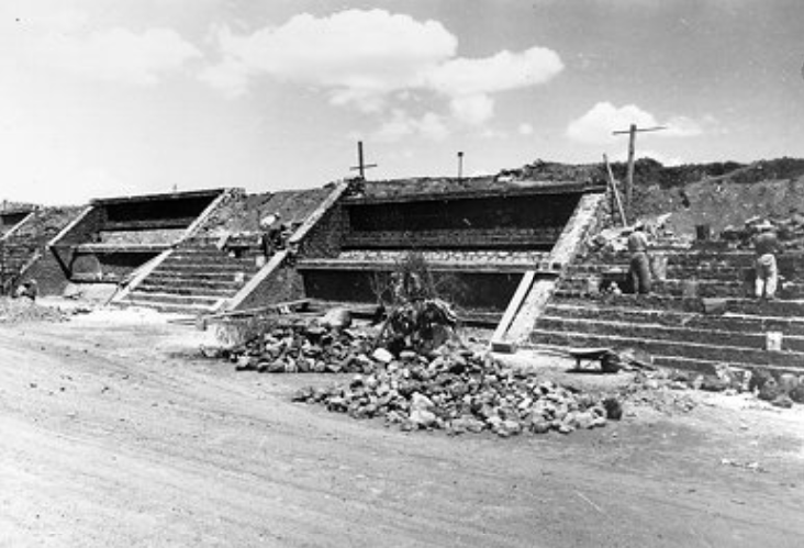
The Teotihuacan Project directed by Ignacio Bernal, head of the Department of Prehispanic Monuments. Although some of the buildings were excavated to learn more about their history, most of them were reconstructed so they could be restored back to the last occupational phase look (Bernal 1997 [1963]) (Figures 19 and 20).
These images document how much change Teotihuacan had undergone in the first half of the 20th century. Although several centuries have passed since its occupation during the Classic period, this site continues to be relevant in the construction of our history. To know more about the history of this pre-Hispanic city, you can check the PPCC’s study area section.
References
Bernal, Ignacio 1997[1963] Teotihuacan: descubrimientos y reconstrucciones. In Antología de documentospara la historia de la arqueología de Teotihuacan, compiled by Roberto Gallegos Ruiz, José Roberto Gallegos Téllez Rojo, and Miguel Gabriel Pastrana Flores, pp. 594-615. National Institute of Anthropology and History, Mexico, D.F.
Pérez, José 1997[1939] Informe de los trabajos de Alfonso Caso y José R. Pérez. In Antología dedocumentos para la historia de la arqueología de Teotihuacan, compiled by Roberto Gallegos Ruiz, José Roberto Gallegos Téllez Rojo, and Miguel Gabriel Pastrana Flores, pp. 488-498. National Institute of Anthropology and History, Mexico, D.F.
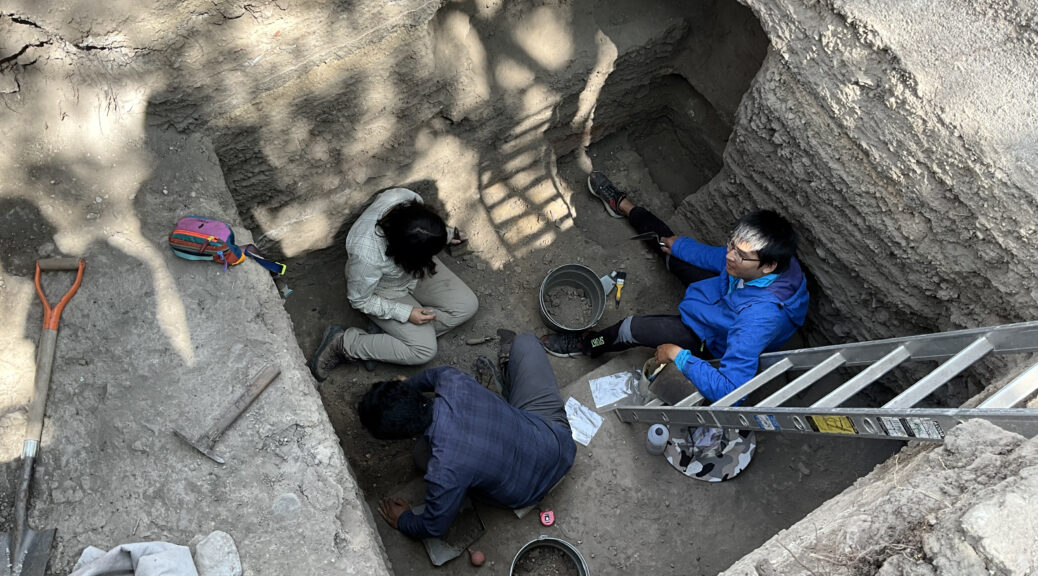
It has been an intense week with the conclusion of the third field season (2017) of the PPCC. This includes putting the final touches on all pending fieldwork tasks: the last photo taken, the final line drawn, and the closing word of descriptions written in the notebook.
We have just three days left for filling in the last four open excavation areas. The first of them extends over an area of 12 meters long by 3 meters wide and reaches depths between 2 to 4 meters. The second area is not that wide but is certainly large and complex; it is a tunnel that runs over 10 meters long, 1 meter wide, and 1.5 meters high. The third one is located on one of the highest structures of the complex covering an area of approximately 9 meters long, 6 meters wide, and 3 meters deep. The last area revisits a tunnel previously excavated during the first fieldwork season in 2015 and continues to provide several interesting finds.
Upon finishing the last field details and closing out the season, the adrenaline runs high with a mixture of stress, anxiety, and emotions. All excavated areas must be cleaned and perfectly covered in backfill.
In order to accomplish these monumental tasks, we rely on local fieldworkers from neighboring communities near the “Zona de Monumentos Arqueológicos de Teotihuacan” (Teotihuacan Archaeological Monuments Area, ZMAT). These individuals are usually young men who recently turned 18 years old (legal working age in Mexico) and thus experience their first job with the project or, on the contrary, are mature men who each have more than 10 years of experience working for diverse archaeological research projects in the ZMAT.
These are the people who do all the hard and labor-intensive work: lifting heavy buckets filled with earth from excavation area to sifting station, carrying heavy stones out of excavation areas, finding out ways to protect excavations from rain by maneuvering a makeshift awning, among many others tasks. Although archaeologists lead the fieldwork and its activities, we acknowledge the hard and important labor our fieldworkers do to support us and the PPCC.
Often times, the fieldworkers have to endure when an archaeologist is in a bad mood during stressful situations due to lack of time particularly at the end of the field season. Despite this, they are supportive and encourage us to continue working on “that what we call archaeology.”
Not everyone can be a fieldworker in an archaeological project as this job demands a balance of finesse, precision, and strength. Finding the right combination and stamina may ultimately decide whether one returns for the next field season. However, we gladly welcome back most familiar faces who possess these characteristics and look forward to working together again out in the field, right until the inevitable stressful end of the season.
THANK YOU TO ALL who supported our PPCC team during this third field season! Muchas gracias!
Featured
Looking for traces of the past: interpreting the surface of the Teotihuacan Valley
During the 2017 field season, the Plaza of the Columns Project used a special type of investigative tool called LiDAR (Light Detection and Ranging) to verify archaeological features out in the field. This method of remote sensing integrates GPS technologies, Inertial Measurement Unit, and lasers in order to collect altitudinal data. The combination of these sources help to define the surface of the terrain by generating digital elevation models (DEM) for us to further interpret and analyze.
In general terms, this technique allows us to recover traces of the past, either pre-Hispanic, colonial, or historical, which today are reflected in cultivated terraces, mounds or artificial elevations, and jagueyes or water reservoirs.
These features are blurred in what are now nopaleras (terrain covered in the nopal or cactus plant), agricultural fields, or even modern day villages. But thanks to this surveying method, one can outline the dimensions and proportions of architectural or hydraulic features of the past.
Coexistence with the settlers
While surveying the area, we have had the pleasure to interview landowners and gather historical information of past populations. They recalled early childhood stories told by their parents or grandparents about the foundation or organization of their communities since the beginning of the 20th century.
In addition to sharing their experiences, they provided information on the elements that we recognize today in LiDAR images. For example, in the town of Ixtlahuaca in the municipality of San Martin of the Pyramids, interviewees Juan Guillermo Castro, Pablo Rivero, Alejandro Hernández Ramirez, and Sebastián Medina shared stories when the only accessible water was from the water reservoir located in the center of the village. They also recalled the time when this part of the valley belonged to the Hacienda of Cerro Gordo. Other interviewees, Genoveva Diaz Alba with her daughters Lidia and Maria del Carmen Delgadillo Diaz, told us that her husband decided to modify the terrain in the 1970s in order to better cultivate it.
In addition to plentiful stories, some locals were highly generous and went over and beyond. Mr. Filemon Macías Juárez of San Lorenzo Tlamimilolpa not only granted us permission to visit his land but also donated a collection of ceramic materials that he collected throughout his lifetime. This allowed us to increase our comparative sample with late materials and correspond them to the Postclassic occupation of the region.
The enthusiasm and cooperation of the landowners are a result of the clear and transparent management of our objectives. Often times, the locals are contacted by other institutions with much less cordial terms. Therefore, we feel committed to establish clear communication and respect. We want them to feel informed and involved, whether by asking them to personally see the work we do, responding and explaining any personal doubts or observations, or adjusting to their needs and availability.
Acknowledgements
It is important to highlight the support provided by the municipal and auxiliary authorities of Ixtlahuaca and Santa Maria Palapa in the municipality of San Martin of the Pyramids. We also thank San Juan Teotihuacan in the Barrio de Purificación, San Sebastián Xolalpan, San Francisco Mazapa, Santa Maria Coatlan, and San Lorenzo Tlamimilolpan. Lastly, we gives thanks to private organizations such as the Animal Kingdom Zoo.
Zooarchaeology is a field within archaeology that seeks to answer questions about past human occupation and their environment through the study of animal remains1. In practice, this means that a zooarchaeologist must be an expert in identifying animal bones. However, animals come in diverse shapes and sizes. How can someone develop expertise in such a broad field?
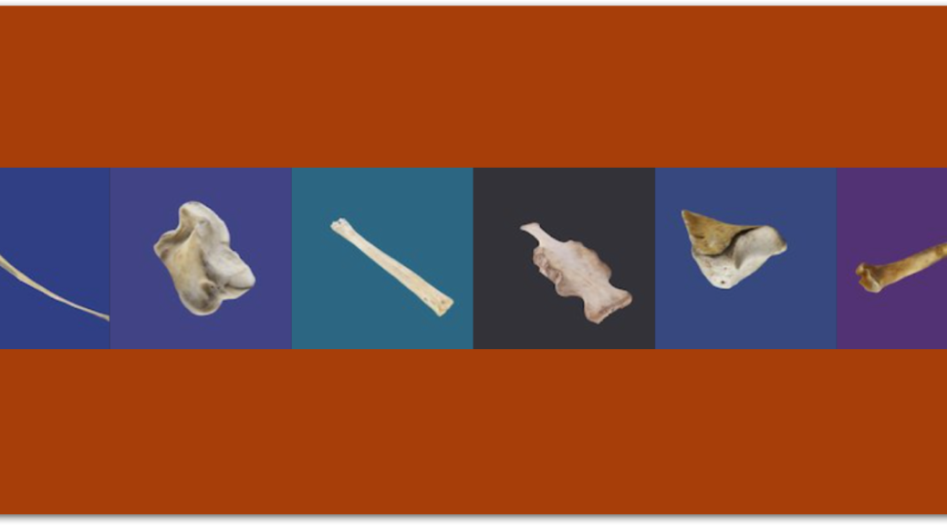
Having a comparative reference collection is key for understanding and formulating distinct patterns among differing species. And this is where I come in. I have just finished a project that helps lay the foundation for zooarchaeology students to build their proficiency in bone identification. Over the last four months, I have created a series of virtual three-dimensional models of deer bones. Everything from a deer’s cranium to the phalanx (or toe bone) is captured in this digital collection. Below you can explore some examples of these models:
So, how do you even start to create a 3D model? Well, it starts with taking dozens of photos of each bone element. I then loaded the photos into a program called Agisoft’s Photoscan which “stitched” them together; by taking multiple photos from different angles and views, the program was able to compile these series of two-dimensional images and transform them into virtual 3D models. After the deer bones were modeled, I uploaded them onto Sketchfab, a website that allows users to display, embed, and share 3D models online. Sketchfab is particularly helpful for this project because it allows students to view the models on smartphones, tablets, and computers alike. It also has the feature to place annotations within each model, as evidenced by the standard measurements and points included on each bone.
I will find out this summer how these models work in practice, for several students from George Mason University (GMU) are flying to Mexico to examine animal remains in the field as part of the Project Plaza of the Columns Complex (PPCC). I spoke with one of the students, Leila Martinez, about how she has prepared for this challenging task of traveling and working without a deer comparative and how she thinks 3D models might help her this summer.
According to Leila, learning zooarchaeology requires extensive hands-on study of bones. With the absence of physical bones in hand, students often rely on animal bone manuals, though these often contain hand-drawn images from few static views. She believes that 3D models may make bone identification easier by letting students interact with realistic images. While 3D technology will never be able to replace the direct tactile experience of working with real bone, in time, these 3D virtual reconstructions could rival traditional reference books. After all, books are bulky and often times expensive, and a digital skeletal collection can be easily transported and manipulated all by the swipe or click of a finger.
Students coming to Teotihuacan for zooarchaeological fieldwork can be an exciting and perhaps a little apprehensive experience, especially when one doesn’t know what to expect when joining the PPCC team for the first time. Is there a skeletal reference collection I can use? How complete is it? In what state are the bones I will be analyzing? Several GMU students like Leila and me already have firsthand experience handling bone with cleaning and labeling the many (or shall I say thousands of) animal remains in our Archaeological Sciences lab. Although real world archaeological assemblages are surely more complex with fragmented, commingled, and/or missing bones, I know the hard work I put into preparing these models of complete bones will help zooarchaeologists to confidently identify the specimens they encounter. Creating virtual 3D reference models is a time-consuming endeavor, but in the end I expect these easily transportable, full of detail, and user-friendly products will play a much larger role out in the field than anticipated.
References
1. Steele, T. E. 2015. The Contributions of Animal Bones from Archaeological Sites: The Past and Future of Zooarchaeology. Journal of Archaeological Science 56: 168–176.
SOCIETY FOR AMERICAN ARCHAEOLOGY 90TH ANNUAL MEETING
Come join us at the Society for American Archaeology’s 2025 conference in Denver, Colorado. This year some members of our team will present the following talk:
SUNDAY, APRIL 27
Symposium: Complex Human-Animal Interactions in the Americas
Room: Plaza Building Director’s Row H Time: 9:30 am
Nawa Sugiyama, Christine France, Erin Thornton, Edsel Robles, and Teresa Hsu—Household-Level Management of Small Game at Teotihuacan, Mexico: Zooarchaeological and Isotopic Proxies from Plaza of the Columns Complex.
