Results 2025
During the summer of 2025, the Project Plaza of the Columns Complex undertook its ninth field season. A team of archaeologists, students, specialists, and local workers participated in different activities. Highlights from the season include excavations, laboratory analysis, a visit from local Xochicalli School, and a mural piece from Front F being displayed at the onsite Teotihuacan Site Museum. In the laboratories, we were analyzing artifacts from prior seasons and preparing samples for analysis at the same time. The excavation team dug a total of 21 pits in Front D.
FRONT D
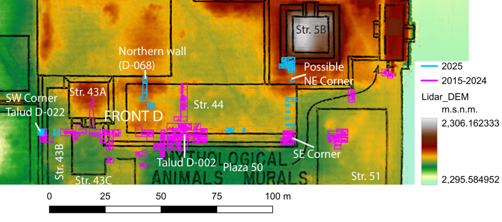
Structure 44: delimiting an important building
Several sections of Structure 44 have been explored in the past years. It is here that the remarkable mural collection with Mayan iconography was found, and it is posited to be an administrative center related to foreign diplomats or state officials. Furthermore, we have found that a portion of the structure was intentionally burnt near the end of Teotihuacan’s time.
This season, the excavations focused on finding the structure’s boundaries. In the northern section, a thick wall was identified that is probably the northern limit of Structure 44 and it is located almost 25m north of the southern talud (southern boundary).
In 2022, the structure’s southeastern corner was identified. Given its location, this season’s excavations focused on searching for the northeastern corner alongside the eastern section. A wall that runs perpendicularly from the eastern wall was found; therefore, it was described as the northeastern limit.
Structure 44’s southern limit was defined in 2016 and named Talud D-002. However, it was unclear how far west this talud extended. Test pits excavated in the past have found a talud with the same orientation below Structure 43. However, this season, a corner was finally found; this makes Structure 44 about 100m long!
Structure 5B: Why do archaeologists choose to excavate in a certain area?
The researchers from the Teotihuacan Mapping Project (TMP) identified certain structures based on observations they made on the terrain. In the image below, the area designated as Structure 5B is shown with a higher elevation, so it was very likely that a structure was located there. Hence, it was taken into consideration when starting to excavate in this region.
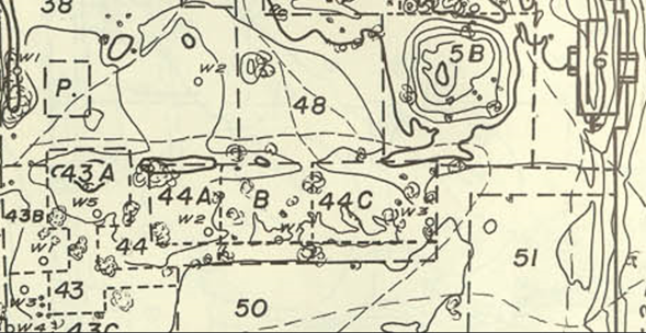
Following the TMP map, we identified the area in which Structure 5B was. As seen in the picture below, what was shown in the map was found when we arrived at the location, and before the start of the excavations, there was a small “hill”.
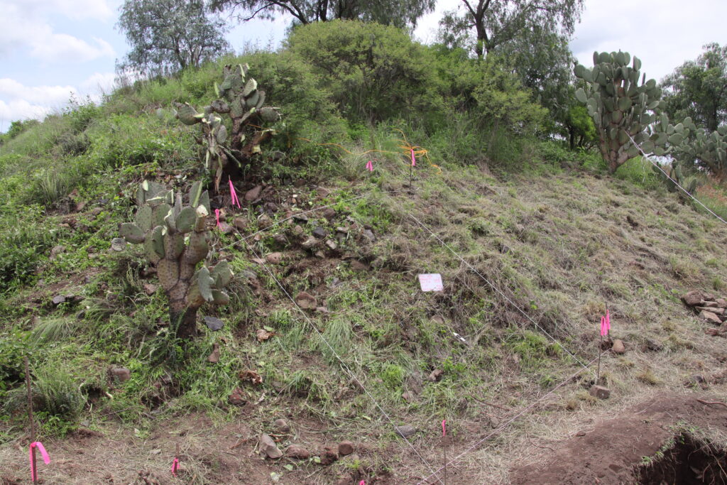
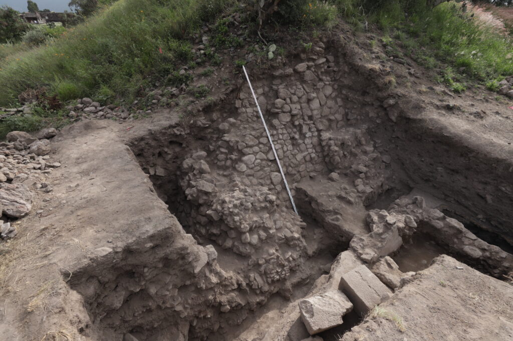
The TMP researchers were right, this mound is a structure! We continue to uncover remains of the ancient city underneath. During the excavations, a section of its southern façade was uncovered. We located the southwestern corner and observed that it was built using stones and cemented with mud. In the picture above, the sloped wall is more than 3 m in height.
Can you imagine what it looked like in the past?
Excited to learn more? Please give us a follow, as we prepare for our next field season in Summer 2026.