Looking for traces of the past: interpreting the surface of the Teotihuacan Valley
During the 2017 field season, the Plaza of the Columns Project used a special type of investigative tool called LiDAR (Light Detection and Ranging) to verify archaeological features out in the field. This method of remote sensing integrates GPS technologies, Inertial Measurement Unit, and lasers in order to collect altitudinal data. The combination of these sources help to define the surface of the terrain by generating digital elevation models (DEM) for us to further interpret and analyze.
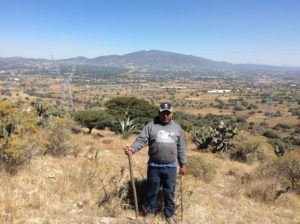
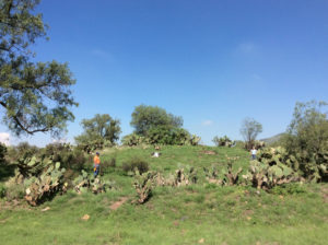
In general terms, this technique allows us to recover traces of the past, either pre-Hispanic, colonial, or historical, which today are reflected in cultivated terraces, mounds or artificial elevations, and jagueyes or water reservoirs.
These features are blurred in what are now nopaleras (terrain covered in the nopal or cactus plant), agricultural fields, or even modern day villages. But thanks to this surveying method, one can outline the dimensions and proportions of architectural or hydraulic features of the past.
Coexistence with the settlers
While surveying the area, we have had the pleasure to interview landowners and gather historical information of past populations. They recalled early childhood stories told by their parents or grandparents about the foundation or organization of their communities since the beginning of the 20th century.
In addition to sharing their experiences, they provided information on the elements that we recognize today in LiDAR images. For example, in the town of Ixtlahuaca in the municipality of San Martin of the Pyramids, interviewees Juan Guillermo Castro, Pablo Rivero, Alejandro Hernández Ramirez, and Sebastián Medina shared stories when the only accessible water was from the water reservoir located in the center of the village. They also recalled the time when this part of the valley belonged to the Hacienda of Cerro Gordo. Other interviewees, Genoveva Diaz Alba with her daughters Lidia and Maria del Carmen Delgadillo Diaz, told us that her husband decided to modify the terrain in the 1970s in order to better cultivate it.
In addition to plentiful stories, some locals were highly generous and went over and beyond. Mr. Filemon Macías Juárez of San Lorenzo Tlamimilolpa not only granted us permission to visit his land but also donated a collection of ceramic materials that he collected throughout his lifetime. This allowed us to increase our comparative sample with late materials and correspond them to the Postclassic occupation of the region.
The enthusiasm and cooperation of the landowners are a result of the clear and transparent management of our objectives. Often times, the locals are contacted by other institutions with much less cordial terms. Therefore, we feel committed to establish clear communication and respect. We want them to feel informed and involved, whether by asking them to personally see the work we do, responding and explaining any personal doubts or observations, or adjusting to their needs and availability.

Acknowledgements
It is important to highlight the support provided by the municipal and auxiliary authorities of Ixtlahuaca and Santa Maria Palapa in the municipality of San Martin of the Pyramids. We also thank San Juan Teotihuacan in the Barrio de Purificación, San Sebastián Xolalpan, San Francisco Mazapa, Santa Maria Coatlan, and San Lorenzo Tlamimilolpan. Lastly, we gives thanks to private organizations such as the Animal Kingdom Zoo.
